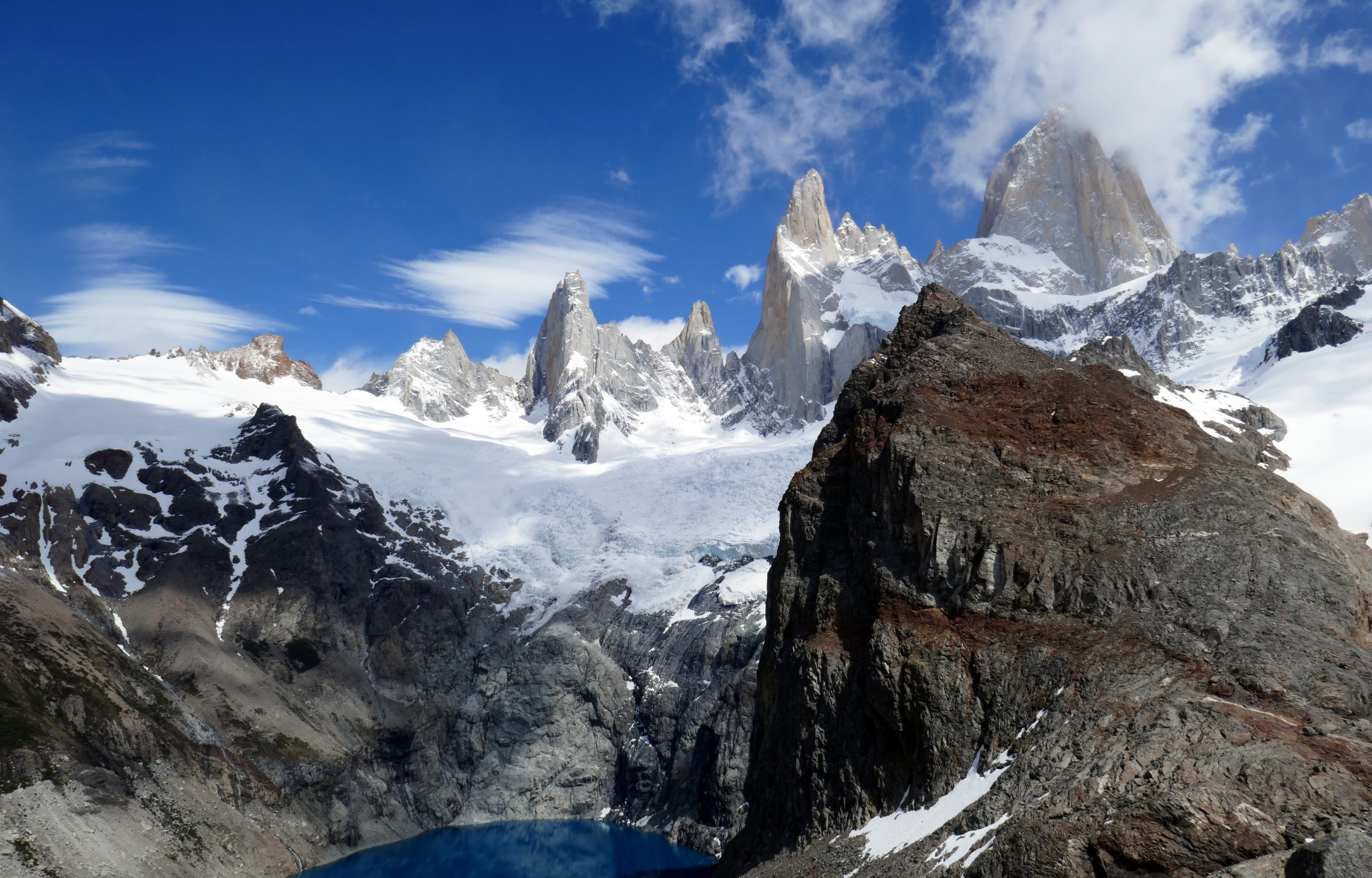
After a very successful hike to the base of Cerro Torre, I had a tough decision before me. How could I ‘top’ that hike for us the next day? After pondering a few routes, I had my eyes firmly fixed on a vantage point that would be a bit higher. So, over the next few days, I was looking at doing a hike to the ‘Loma del Pliegue Tumbado’ (Tumbado Peak), as well as a longer hike to the famous Laguna de Los Tres, which sits at the base of Cerro Fitz Roy. Both hikes would feature some great climbing, and hopefully more amazing views. Unfortunately, when I woke up on the first day, and shook Deanna gently awake, it was obvious she wasn’t feeling hot. I decided to delay our departure a little bit, and went out to fetch us some baked goods for breakfast. When I returned, Deanna said she really didn’t feel up to a hike, but that I should go. I was reluctant, but at the same time, “Once in a lifetime” was in my head, so I decided to go, leaving her to rest and recover for the day.
Day 3: Hike to Tumbado Peak
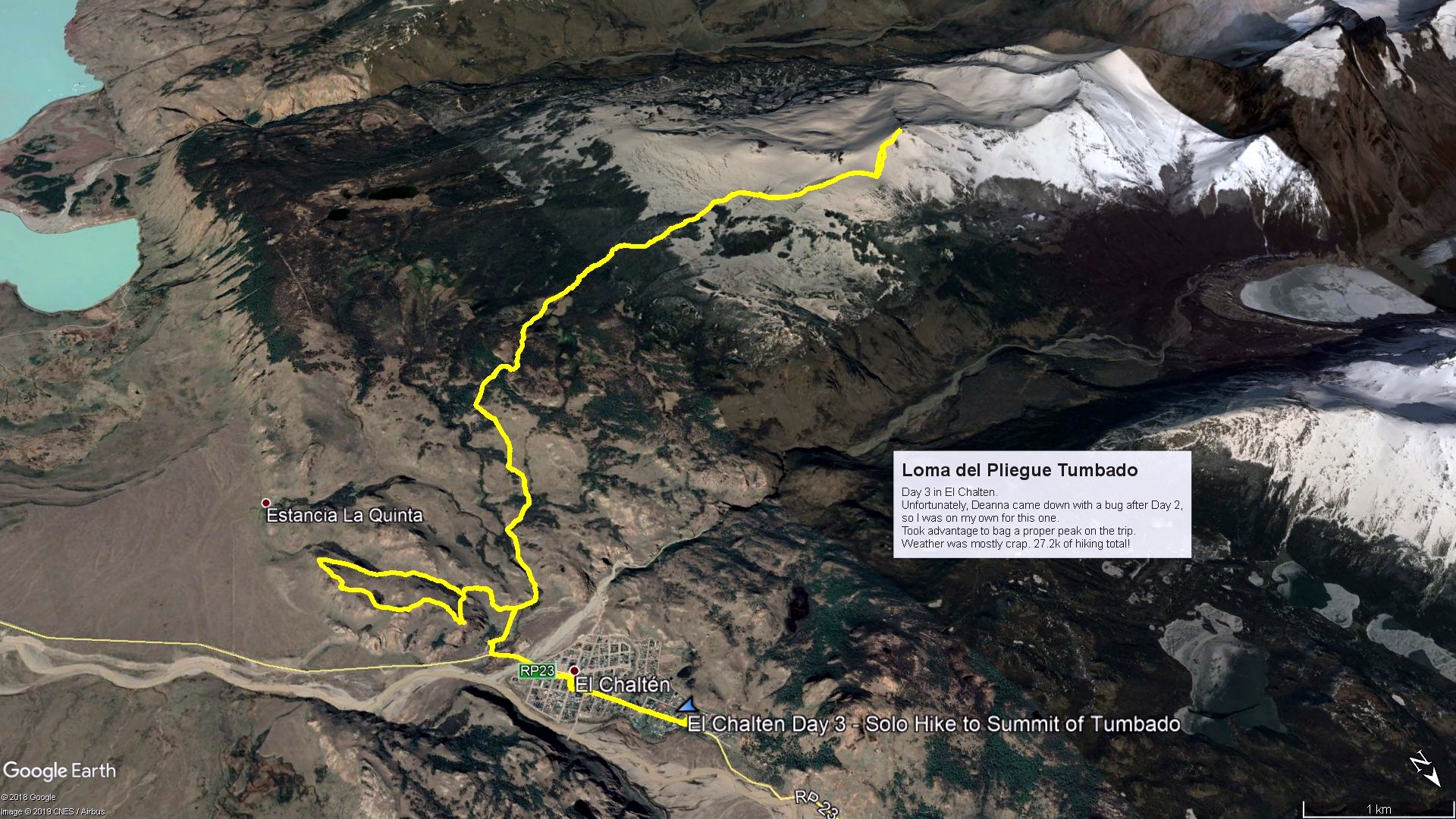
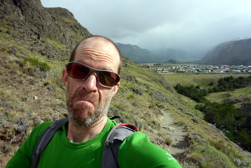
Seeing as I was heading out solo now, I re-evaluated my routes and what I felt like doing, as I could potentially ‘push’ a bit harder. With the late start though, I opted to head to the other end of town and stick with my plan of a summit on Tumbado (although now going ALL the way to the top, which wasn’t the original plan). However, my challenge was clearly the weather. The day was already grey, cold, and slightly wet, and that was at the BOTTOM of my long climb up. This climb would have the most gain of El Chalten, with over 1,000m of climbing over the 10k to the top. To be safe, I popped into the ranger station to ask about my chances with the weather. They pretty much told me to abandon any hopes of views at the top, but did volunteer that the trail was a really good one for ‘training’, thereby motivating me to go up regardless. They didn’t think it would be dangerous today (since I had the gear), but not the type of weather most would enjoy. But I’m not most ;-).
Mentally committed, I headed out from the ranger station and started the long climb up. It wasn’t long before I ditched the rain jacket for now. I was moving fast and getting hot quickly. I decided with the merino wool I was wearing, even if damp, I’d stay warm, and would rather save the shell in case I would really need it. The hike was great right off the bat. This was clearly a lighter trafficked route, and with the weather, I was alone for much of my journey up. Before I knew it, I reached a fork in the trail. Left for a remote lake, and right for the peak. I went right and didn’t look back. The terrain started getting a bit more interesting from here on up.

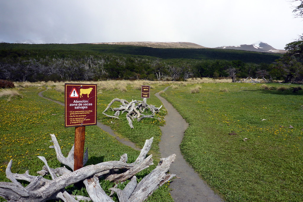
I entered forest for a while, where I did pass a small group of determined hikers. It appeared they may have started a while before me, and were already struggling a bit. I wished them well as I jogged past. I was salivating at the prospect of getting to the top alone, even though it may be anti-climactic. The climb was fun, and I was marvelling at the strength of the trees around me. They looked scraggly, but I could tell what I was really seeing were some VERY hardy trees that must grow and live in the most difficult of conditions on this mountain. After a short while, I emerged from the woods into yet another world in terms of terrain. I was now above the tree line. The landscape began to take on a moonscape atmosphere.
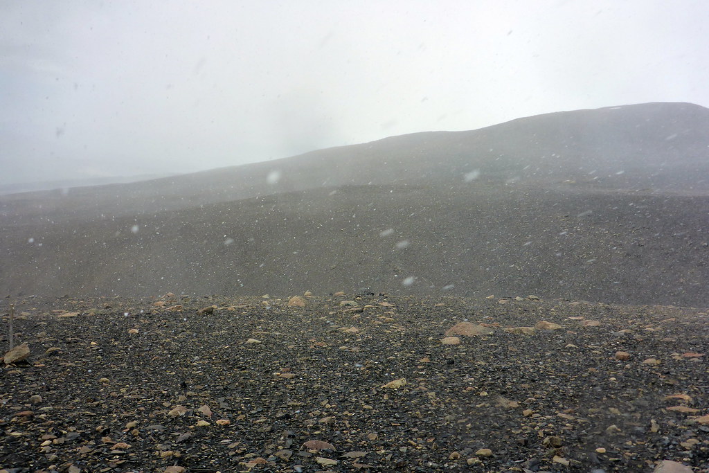
From this point onward, the objective was plainly visible ahead of me, but seemed far off and rather daunting. The ‘trail’ became much more challenging to follow, as this was just a rock-strewn wasteland. To help, the park had installed orange trail markers every 50m – 100m, which were designed to help guide hikers in the case of bad weather. That was a good thing, because the weather also nose-dived, and I found myself climbing in a SNOW STORM!!! I’m not kidding. The wind whipped up, and it was hailing / snowing quite heavily. So much so that I had to seek shelter in order to put ALL my layers on, including gore-tex pants and jacket, along with hat / gloves / buff to protect my face. It was wild, and I was LOVING it!!
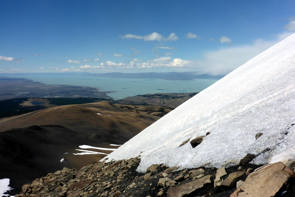
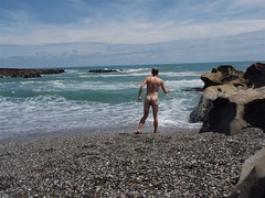
I will admit that at one point, I questioned my wisdom, but I felt strong and warm, so I decided to roll the dice and press on. Shortly, I arrived at the ‘official’ viewpoint. It was like staring into a grey void. There was NOTHING to see. I knew that was a risk. To my left, however, was a very tempting looking steep snow-covered peak. Consulting my handheld GPS, I determined there should be a route to the top, so I decided to head up, just for fun. But here’s the amazing thing. As I made my way up, it cleared in spots! So much so that on this climb, I got to see the giant Lago Viedma far off in the distance. This buoyed my spirits and in spite of a slippery climb up the snow and ice (without crampons), I made it to the Summit. Not only that, but I had a respite in the wind, the sum came up, and I had the most amazing solo picnic maybe of my whole life up here. I was so happy that I had rolled the dice once again!

After enjoying about 20 minutes at the top, I decided not to press my luck, as the angry clouds rolling in from Cerro Torre’s direction told me things wouldn’t stay clear long. Coming off the peak was much easier, as I decided to butt slide down the steep snow, using a rock to brake as needed. It was fun :-). This meant in no time I was crossing the barren landscape again, which is when the snow enveloped me again. I couldn’t believe my good fortune with the summit weather window. Once again I was stuck to navigating stick-to-stick for a bit until I re-entered the fores.

Once safely down towards the base of the mountain, I looked at the maps once again, and decided to tack on a couple shorter hikes to some village viewpoints. These were called Los Condores and Las Aguilas viewpoints, and were in the hills above the ranger station. These are the ‘tourist tracks’ that most will visit on short stops to the town, as they offer views of the towns and mountains without needing to walk more than about an hour in total. In my case, I’d already been out for a long time, but the promise of views again tempted me. The allure of Los Condores was a nice overview of the entire town. It was mostly clear hear. Las Agilas is a cliff-top view in the other direction looking out over the high plains towards the big lakes. The view was only so-so for me due to clouds and rains.

By the time I wrapped up these two trails, I had covered over 27 km in total for the day! Not bad for a late start, bad weather and a mountain climb! Speaking of bad weather, things closed in again on me on the last stretch, with heavy rains following. I trudged through the downpour, tired, until finding refuge in a bar called La Vineria, which promised an extensive craft beer list and a Happy Hour where I’d get some tasty beers for low prices. I was perfect for drying off and warming up before the final cross-town trek back to my patient! I grabbed soup and bread on the way ‘home’ to make supper for us and see how Deanna was doing.
Day 4: Laguna de Los Tres the Long Way
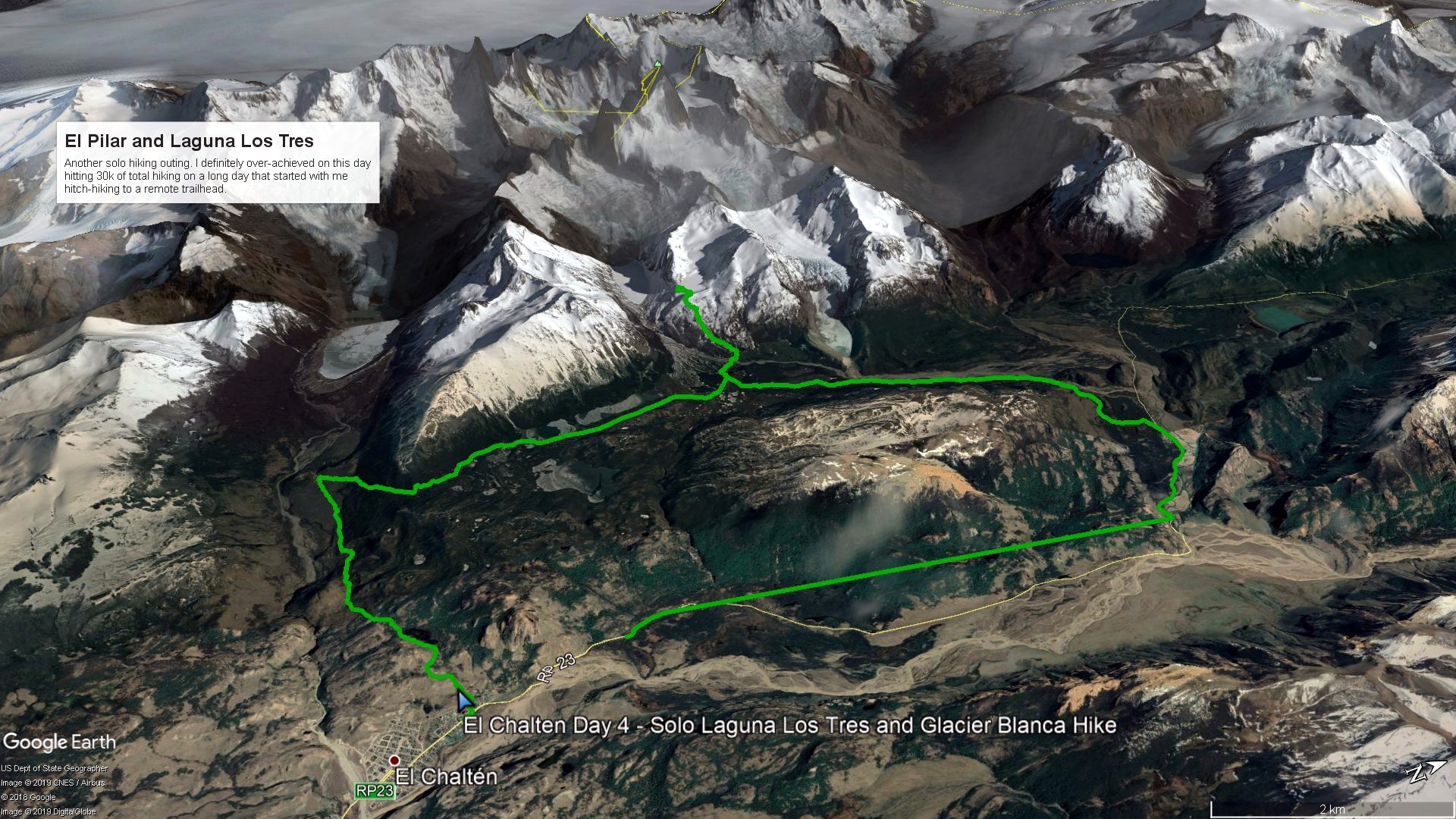
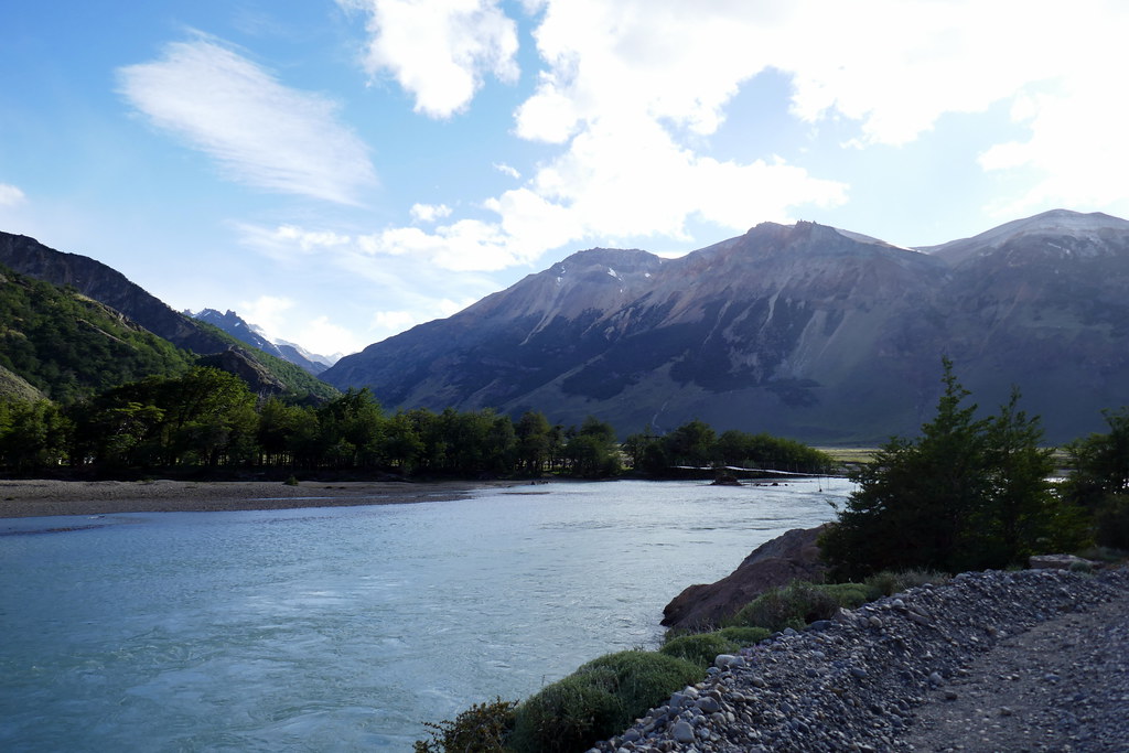
Day 4 turned into a real doozie for me, somewhat unintentionally. The night before, it was clear Deanna was still in no condition for a hard hike. We discussed it, and decided unless she felt way better in the morning, I was again on my own. As such, I made a few different plans depending on the morning. 6am the next morning I was up and packing. It was thumbs down from Deanna, but encouragement to have an adventure. And so I pulled the trigger on my ‘A’ Plan, which involved hitting the road an hitchhiking to a remote trailhead at ‘El Pilar’ in order to take a long, circuitous route to Fitz Roy, then back to town via another side trail to pass a couple lakes. On paper it looked like a solid plan, but I had no idea how long it would be. Undaunted, I set out, and learned that 7am hitchhiking on a remote dirt road in Argentina isn’t easy. Several ‘tourists’ passed, ignoring me, until finally, a local tradesman let me hop in the back of his truck to take me up the road to within a couple kilometers of my chosen start point. Luckily, it had taken me less than an hour to get here!
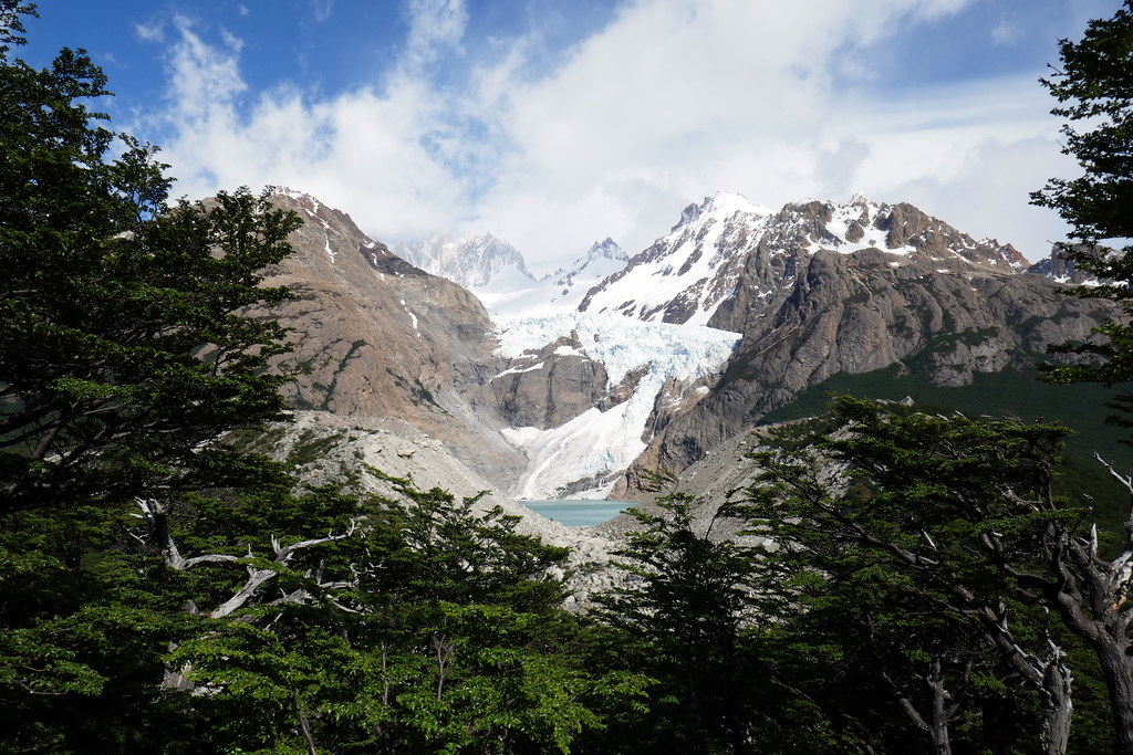
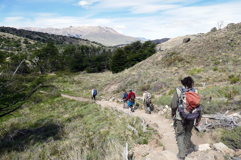
At this point, I turned onto a trail which meandered its way along the Rio Blanco, and past some pretty impressive views. The main sight along this trail is the Piedras Blancas Glacier, and the associated glacier lake at its foot. To get there had been some great rolling forest trails with more of the super tough trees I’d come to grow respectful of during my hikes. I was not alone today, and passed a couple different guided groups that had started earlier. It’s a popular destination route with day-hikes who get shuttled to the start, then hike back to the town on a shorter route. But regardless how you got there, the view of this glacier was pretty cool, and was a good prelude to the big show that I was hoping for in a while.
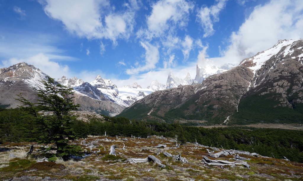
To this point, the going had been very easy, with mostly flat terrain and easy footing. However, I soon arrived at the campsite known as Poincenot, which people use as a base camp for the climb to Laguna de Los Tres and beyond. At this vantage point, I could finally clearly see Fitz Roy, and the crux of this days adventure, since things were still far off, and mostly uphill. I re-joined the main trail here, and made my way to the goat track that is the climb to Laguna de Los Tres. You will know when you are at the start of the climb, as there is a 1-lane bridge everyone needs to cross, and there is often a lineup. Since I had taken the long route, things were already busy here, but in no time, I was starting up the VERY steep trail.

At this point, I was on one of only 2-3 trails that are labelled with a triangle and exclamation point. “Very steep trail. Dangerous when it’s windy and rainy”. Happily, it was almost a bluebird day, so of course I decided to time trial the climb 🙂 . I’m not sure everyone was happy when I came bounding rock to rock heading uphill, but I was in my own little word of pleasure. The earlier chill of the day was long forgotten as I drenched my top from the exertion, but I felt so alive heading up. I managed to complete the entire climb in just over 30 minutes. The final scramble of the climb was up and over a scree hill, so the views were obscured until you finally crested the trail at the top. Seeing Fitz Roy this close was worth it.
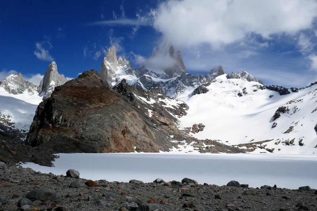
Truth be told however, I think it isn’t just the view of Fitz Roy that made it worth the effort. The lakes of Los Tres and Sucia provide the most drama, as the ridiculously blue waters give a great contrast to the rocky peaks. You can imagine my surprise then when I discovered that Laguna de Los Tres was COMPLETELY FROZEN and covered in snow! I hadn’t done my homework on this little bit of intel. I was momentarily disappointed thinking that this was it, and would be all I’d see. Additionally, there were wisps of clouds obscuring the mountains just enough to not show their full majesty. I made the best of it, opting to have my lunch up here anyway, enjoying the views that I did have.
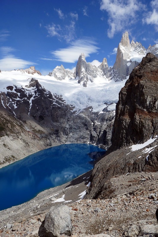
The news was not all bad though. After hanging around here for over 30 minutes, and capturing a little timelapse video of the mountains, I headed out exploring. I followed various trails and footpaths all around Los Tres before arriving at the most stupendous views, thanks to Lake Sucia, located only a few hundred meters away, but completely thawed and an amazing blue colour!
I had almost left the summit a few minutes before, not even realizing that this view existed, as you had to go a bit off the beaten path to find appropriate vantage points. I guess it always pays to do a little exploring, as this set of views and photos totally made the day, and put the exclamation point on the entire Patagonian trip for me. After revelling in the sun and views a little longer, I reluctantly headed back, knowing I still had a long hike back to El Chalten.
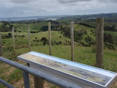
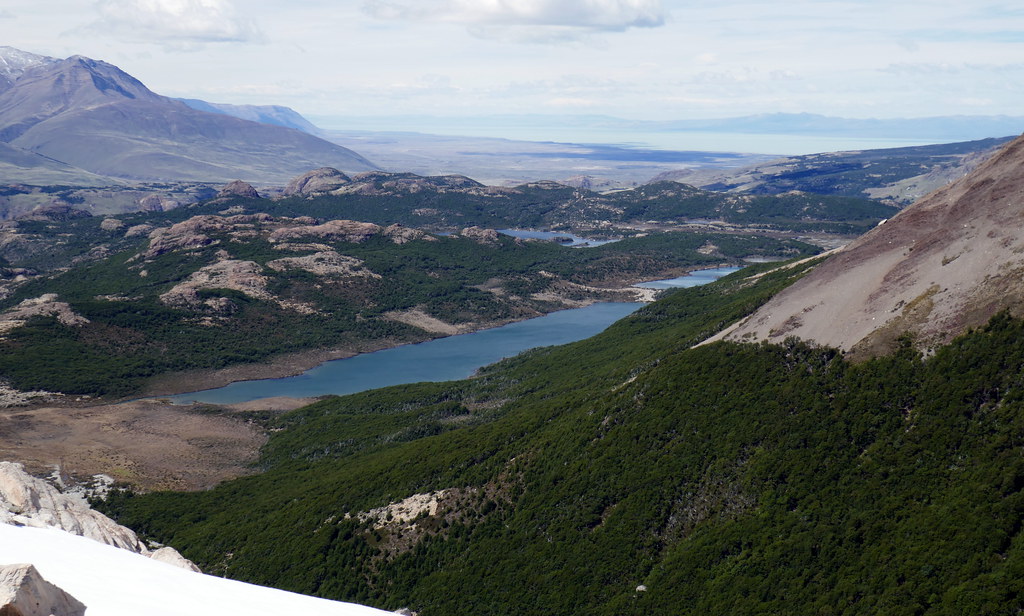
As I started back down, I actually had a very good view of the area I was headed to. I had opted to hike a side trail along Laguna Madre and Laguna Hija (Mother and Daughter Lakes). This trail was a linking trail between the two major hikes to Fitz Roy and Cerro Torre. Since I’d already been to those, I wanted to see this trail. The picture below had a great overview of these two lakes, as well as Laguna Capri, which I’d visited 3 days ago with Deanna.
This final set of trails wasn’t overly difficult, but I was starting to feel the cumulative effects of two days of hard hiking with decent elevation gain as well. After all, today’s hike would clock at over 30k when I was all done! At one point along the lakes, I questioned my decision, as I was hot, tired, and a big hungry. When I finally finished this trail, I linked up with a familiar trail from 2 days ago, and eagerly got on it to wrap up my day. At one point, I joined in behind local trail workers. They had a great pace going, so I fell in with them. I’m not sure if they were impressed or annoyed that I could keep up with them, but eventually we shared a few words along the way and all hiked out a final bit of ‘off track’ trail back to El Chalten.
I capped off the day by heading to another local brewery known as Don Guerra. I had managed to get a message out to Deanna, who joined me briefly at the bar. She’d rested again all day, and while not feeling great, was at least mobile for the first time in 2 days. We didn’t push it though, and returned to the hostel to plan our final day.
Day 5: Chorillo del Salto (Waterfall Trail)

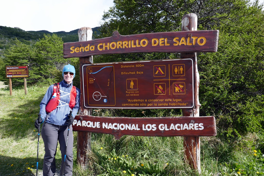
This was our final day in El Chalten, and last day that we could do anything ‘active’ in Patagonia. Starting early the next morning we’d be embarking on a 2.5 day journey back to Ottawa. Rather than doing a crazy hike though, we settled for a shorter hike to a nearby waterfall. We had tried to start back up towards Fitz Roy, but as soon as we started the steep climbing, it was clear Deanna wasn’t up for it, so we doubled back an took the ‘easy’ route. Given my last couple days, I was totally fine with that, since I wanted to end the trip with Deanna by my side anyway for one last little adventure. On the day, our total distance was only 8 km, but it was a lovely hike to a peaceful place. Admittedly though, after spending time in Iceland, there was no way this ‘waterfall’ was going to measure up!
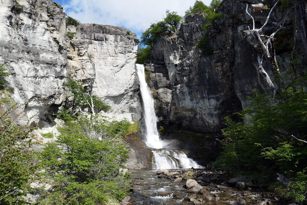
Regardless, we made the trip, and sat for a while soaking in the scenery and reflecting back on our last 2 weeks of adventures in Patagonia. The amount of sights we’d seen, and cool hikes we’d done left us feeling completely satisfied with the trip. Getting to Patagonia had been on my bucket list for years, and I am so glad we were able to make this trip happen, and not only that, but on our own terms, and under our own power. I like group trips as well, but there is just a bit more satisfaction in ‘fending for yourself’ on an adventure like this. After completing our commune with nature, we doubled back and headed back to the hostel to take care of packing up all our gear for the buses and flights ahead.

For our final night, we decided to head to another highly recommended restaurant. This place went by the name of Maffia, and was an Italian Bistro. It is so popular, I’d actually made pre-emptive reservations the night before to make sure we got in. Everything is made from scratch, and they even grow all their own herbs for the dishes.
The food was absolutely amazing. Yes, it was not ‘South American’ cuisine, but it was totally worth checking out an Argentinian’s take on traditional Italian pasta, and we were NOT disappointed. After our early supper, we picked up a final bottle of Argentinian red wine to share at the hostel in the common area.
With this final instalment, this brings me to the end of our Patagonia trip. All in all, we got everything we wanted to out of this trip, and can’t speak enough about how much fun it was. Although it is on the pricey side to get to this part of the world, the on-site costs were very reasonable, so if you get the chance, you owe it to yourself to see these sights for yourself. Hopefully these stories have given you a taste to do just that! Until then, remember you can find adventure wherever you are, you just have to look for it (and/or create it!). Stay safe, and see you all out there!