Yearly archives: 2008

129 posts

From High up to Down Low

14/01/08
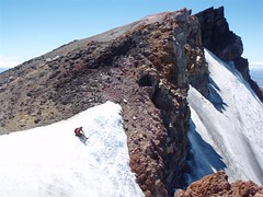
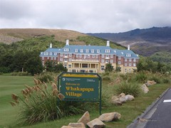
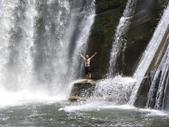
Happy Monday to you all! As you’ve probably noticed, I was unable to post anything last night. This wasn’t because my hostel didn’t have the facilities, but rather because according to the manager there, the Internet was down all across New Zealand. That’s too bad, because I was hoping to get you caught up on my exploits. However, as I now find myself in essentially the middle of nowhere (Raukawa Falls), I still won’t be able to post anything. I have high hopes for tomorrow however, as I’ll be in a town of over 40,000, so surely they’ll have fixed the Internet there, right? Hee hee. Well in spite of that, my trip continues, and I have a new post to write for you all. Today Ralph and I bid farewell to Tongariro National Park, and made our way (mostly downhill) to the Raukawa Falls Adventure Centre, which is a YMCA camp, but also has cabins for independent travelers. We got a cabin for 15NZD each. Not bad. The location isn’t too shabby either, with some really cool falls nearby, as well as a flowing river behind our cabin. So, read on for my little story, and don’t forget to check out the day’s map. With the return of reliable power, I can give you an accurate map now 🙂

Ceiling of the North Island

13/01/08
Yeehaw! I did it! I reached the highest point in the North Island of New Zealand. Yup, Ralph and I achieved our goals yet again on another glorious day in Tongariro National Park. We managed to summit Mount Ruapehu, through the aid of both a car, and some chairlifts. Hows that you say? Well, the start point was 6km up the road, very much uphill, so we decided to hitch-hike up and back instead of biking. Also, rather than try to scale the entire vertical distance by foot, we took the park people’s advice and paid 20NZD for the chairlifts to take us up to 2000m, leaving us only an extra 700+m of vertical to climb. Our plan was to be on the first chair at 9am, and be back in Whakapapa Village around 1pm, and in National Park Village and the included spa by 3pm. Read on for a bit more of the day, and check out the map. Sadly, the GPS was paused at some point early in the climb, and I didn’t realize till much later, so a lot of the pictures are in the wrong place. Sorry, but that’s the best I can do for now.

Scaling Peaks in Sunshine

10/01/08 to 12/01/08
Good day to you all! Well, it’s been several days since I wrote a blog post, primarily because there was no way I was going to lug a computer around with me on the highest peaks of the North Island. Not that I’m not loyal to you all, it’s just that there wasn’t going to be any power anyway, and I really wanted to focus on the hiking and the sights. Let me tell you right off the bat, I was not disappointed in any way with my decision to spend 3 days in Tongariro National Park doing the Tongariro Northern Circuit with Ralph. I’m not sure how I can actually write a blog post that does any justice to my experiences in the past couple days. They are just so numerous and awe inspiring that it’s really one of those experiences you’d have to be there for. The pictures are probably the closest thing, and those will have to wait until I send a CD of the full-resolution pictures for Jody to post for everyone. It was just that good. In any case, you can for now check out two maps for days one and part of day two before the GPS batteries died. What follows are a few more of my thoughts on the experience, and what lies ahead for me.

On the Road to Mount Doom

09/01/08
Howdy winter folks! ActiveSteve here, reporting from Tongariro National Park. Today’s bike ride was more or less a highway to heaven sort of thing. It was a steady all day climb, where we started at 380m, and ended up at 1140m, in a little place called Whakapapa Village, which is near one of the busiest ski areas in the North Island. Of course, it being summer over here, the town is a little more deserted. Basically, anyone who is up here is here for one reason alone. To do some hiking in the National Park area. Were there not so many clouds hanging out right now, I’d have a pretty splendid view of Mount Tongariro and Mount Ngauruhoe. Not to mention Mount Ruapehu, the tallest of the lot. So, what’s up now you ask? Well, read on and I’ll spin you a little yarn.

Rainy Day Riding

08/01/08
Hi folks! Well, this should probably count as the shortest post thus far, as it was a very uneventful day for me. I woke up, it was raining, I got on my bike, it was raining. I pedalled for 3 hours, it was raining. Got to the hostel, it was raining. Yup. Rain city over here for the day. As a result, my little map has a grand total of 3 pictures, one of which you see here, and 2 of which were taken at pretty much the same time. There just wasn’t anything to photograph for you! Sorry! In spite of that, I’m now in Taurangi, and feverishly planning out my next several days, in which I will truly be out of contact completely with the outer world. Yup, I’m planning to (along with Ralph) take a stab at the Tongariro Northern Circuit, as well as summitting both Mt. Tongariro and Mt. Nguarahoe. You might know this area more as Mount Doom from Lord of the Rings. Read on for a little bit more.