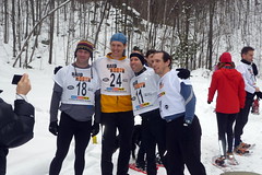
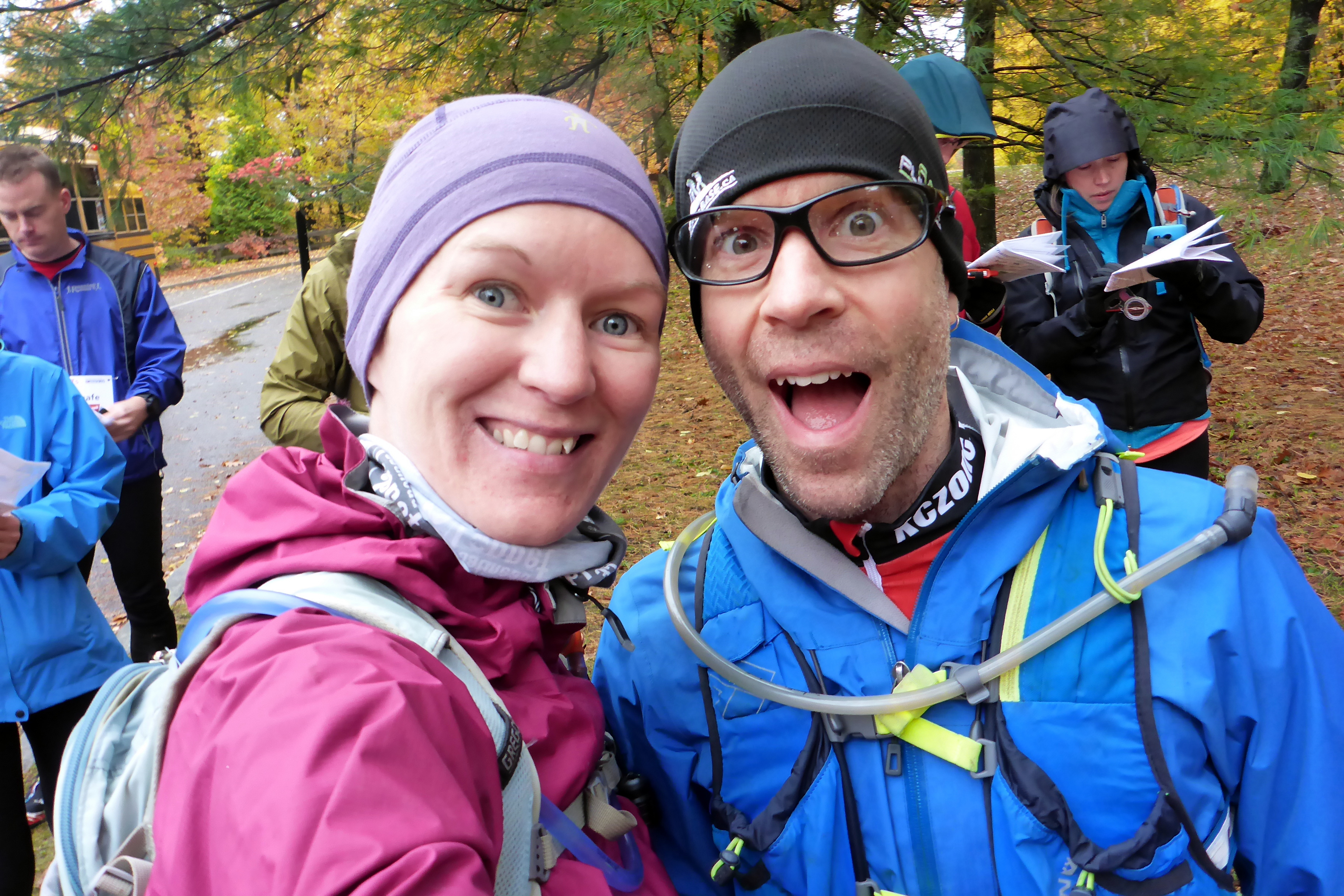
Well would you look at that? Less than a week since my last race report, I’m here writing about another impromptu race that I signed up for over the weekend. Well, ok, to be fair, I actually signed up for it on Wednesday this time, so not totally last second, but still, if you’d asked me a week earlier what my plans were for the weekend, I would have said ‘no plans’. The race in question this time? Challenge the Gats Rogaine. As a refresher, Rogaine stands for Rugged Outdoor GROUP Activity Involving Navigation and Endurance. In my case, essentially a 3-hour orienteering race. My group? Team Hyper-Active, consisting of Deanna and I. Yup, that’s right, a husband and wife team of super outdoor fun! Read on for the nitty gritty.
We entered with no particular expectations or goals (well, apart from the fact that I enter every race *hoping* to win!). For my part, I was looking forward to working on my navigation and route decisions, as well as using a thumb compass in an orienteering race. Knowing that we’d be unlikely to ‘clear’ the course, I wanted to see if I could plan an optimal route to get as many controls as possible, and also adapt on the fly if we were running short of time. As for Deanna, I’m pretty sure she was just keen to have a fun day stomping around in the woods with me, and maybe picking a bit more experience with maps and terrain.
Friday night was a soggy mudfest riding my bike home, and glancing at the Saturday forecast confirmed that we’d be up against more of the same. Temperatures around 4 degrees, potential of pouring rain, and lots of high winds to keep it all interesting. What could be better? On the plus side, I tend to thrive when others get grumpy about bad weather, AND we could just wear rain jackets and pants, so the discomfort wouldn’t be that bad.
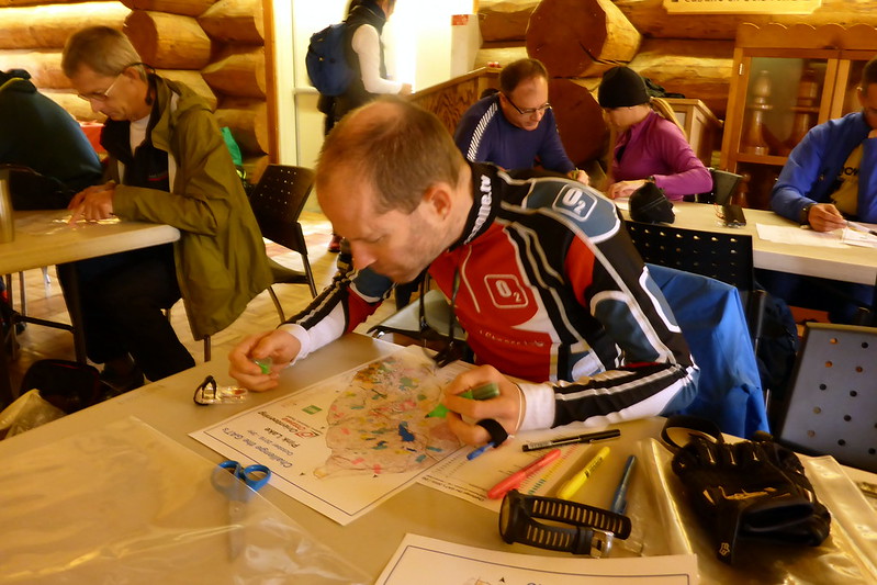
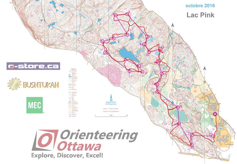
After arriving and registering at the race HQ, we anxiously awaited our maps and instructions for the event. There were 2, 3, and 6 hour events. Lucky for us, the 3 hour event only started at 12:40, so we didn’t have to show up until 11am. Maps were distributed at 11:40, where we learned that we’d have 30 controls scattered about. Point values ranged from 35 to 80, with the higher value controls in trickier to navigate / ambulate towards. We had to catch a bus to the start line at 12:10, which didn’t really leave much planning time. My approach was to simply highlight the controls in 3 groupings for points. Blue were the bottom 10, Yellow for middle 10, and Pink to denote the 10 highest value controls. This is a quick way of visually scanning the map on the run to a) see if you are missing any nearby controls b) triage which controls are worth trying to get to in the limited time you have.
Frankly, I was surprised to see a lot of teams NOT take this simple approach. On the maps, controls are in brown text, and easy to miss on the run. I thought it made more sense to do what I was doing over trying to sketch out an exact route. Too many variables in the short race to choose a single route. I did mentally go over a number of route options, but didn’t settle on even the first decision until we were on the bus riding to the start. By the time we were gathering at Pink Lake lookout for the start, I had a pretty clean plan of attack. We’d seek to clear the northernmost controls, heading roughly clockwise, then make decisions based on timing. Given the time, we had to average 6 minutes per control in order to clear the course, and there was no way we’d maintain that!
With the starting gun, we got right to work, keeping a nice steady run/jog pace for the first CP. Luckily, I was familiar with a lot of the ‘secret’ trails in this area, so nabbing the first 3 CPs was pretty easy. We picked them off in about 15 minutes, putting us in the black. The next one was also easy, giving us confidence and 4 minutes in the bank. However, the next couple controls were ‘pink’, high-value targets, that took us quite a bit longer. While the weather was not bad (yet), some of the terrain was throwing our pace off. Deanna found it a bit tough to navigate over thick deadfall in places, so we slowed a bit to not get too pooped later. Luckily, we were having fun and working well together. Turns out Deanna has great spotter eyes in the woods. She often spotted the orienteering flags before I did once I’d give her the features to look for and where to scan.
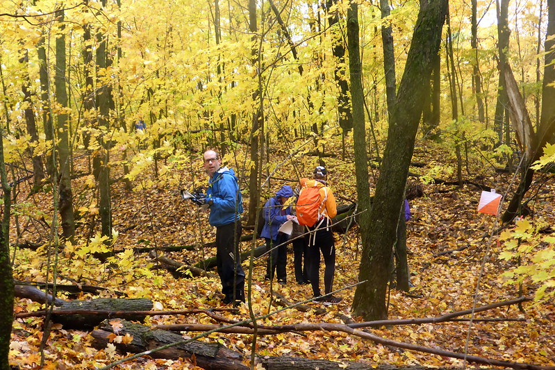
I think somewhere around the 8th control I had to start making decisions on where to skip controls. I didn’t like admitting ‘defeat’, but realistically, we’d never get to some of the outliers. I had my eye on a string of 4 high-value controls along ridges further on in the course, and wanted to make sure we nabbed them. As such, we ditched 4-5 in the NE section of our map, as I couldn’t find an easy routing to get to any of them and stay on track. Somewhere around the 1h15 mark, the rain started on us. At first it wasn’t too heavy, but about an hour after that, it really started to pour on us. Our feet were thoroughly soaked, and in spite of rain coats and pants, the heavy exertion meant we were soaked on the inside anyway, whether it was rain or sweat! Waterproof breatheables my ass. No such thing as a breathable coat when you are actually working hard!
As we worked our way south, I had to be even more detailed on my nav decisions. The clock was ticking, and you didn’t want to finish late. Technically, the race is done at the 3 hour mark. However, you can finish late. BUT, for every minute you are late, you lost 10 points! So it’s a fine line between getting a control and finishing as close to the 3h mark as possible. I’d say I was reasonable in my estimate, but time would tell whether I’d meet the goal. In the string of 4 on the ridges, I bobbled a bit on one of the controls. It was located on the ‘foot of a cliff’ somewhere in a maze of hills and cliffs. Being 30m off in terrain like this can mean having to climb all the way up and down another steep hill to find a control, and it can be really tough to know exactly where you are on a map when there is no ‘YOU ARE HERE’ blinking icon! Just when I started to get frustrated, I found the control, but I think it took us 15 minutes from the previous one!
Entering the home stretch, we were once again heading to familiar terrain. 4 Controls were located in a network of trails I used to run, bike, and snowshoe on when I lived in the Plateau. I looked at our time and decided we could only grab 3 of the 4, so we set off.
Nabbed the first one easily. HOWEVER, I then made a bad trail decision taking us DOWN the hill rather than across a ridge. Ultimately, this meant we’d have to do extra climbing. As a result, I changed our plan and swapped out one control for another. Seeing only 10 minutes left on the clock, I knew we were sunk. We had 15 minutes of RUNNING to finish, and that was generous.
I knew Deanna was starting to be tired, but I pushed an encouraged as best I could. I plotted out an ’emergency’ route that would take use close enough to 2 more controls that I could quickly run uphill to grab them while Deanna would follow a little further off. The plan here was to grab ‘bonus minutes’ while we made our way back. If we just beat a trail back, we’d have lost more points. This way, I grabbed a 73 point control and a 35 point control, basically giving us an extra 10.8 minute cushion. By this point, we were cold, tired, and very wet, so I had to very tactfully push Deanna by encouraging her to give it her all and remind her that every minute we were giving up another hard-fought 10 points. She dug deep and did her best, never complaining (I’ve taught her well from AR!).
We finally crossed the last field and punched in 9min 55s after the cutoff (or 100 points penalty). Thank goodness for the ‘cushion’ we’d grabbed on the way back. We had no idea how that result would stack up, and just focussed on getting the hot meal and changing into dry clothes. We got to chat with lots of other racers from both the 6h and 3h race to see how they all did. Everyone agreed that in spite of late day rain, it had been a great day of playing in the woods. I was very happy with how Deanna and I raced together, and also quite happy with my navigation overall. In the end, I’d say there was really only 2-3 controls that took a little longer that I would have liked, with the vast majority having been navigated to pretty much dead on.
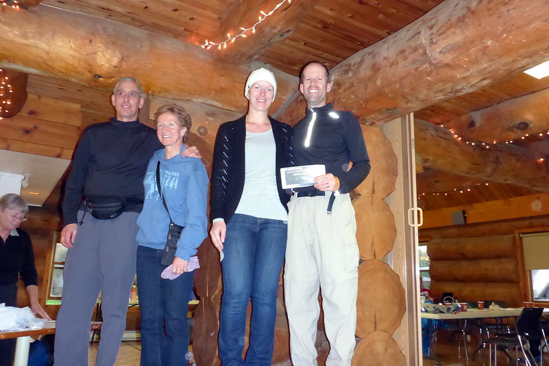
Eventually, I strolled over to where results were being displayed. I was surprised and delighted to learn that we had won the co-ed category with a score of 1080. Not only that, but we were 300 points ahead of the 2nd place team! Looking at the overall results, I was even more pleased to see we managed 3rd overall! The best finish was 1544pts, 2nd was 1487pts, and then us with 1080 points! How cool is that? We certainly hadn’t expected to do so well, but I guess that’s what happens with a postivie attitude, and no dilly-dallying in the middle of a race! Oh, that and strong communication and willingness to push through the tough parts! I think Deanna was even more proud of us than I was. It was definitely a great way to end our day. We decided that deserved some celebratory wine and sauna time later in the evening!
Well, that does it for my little race report. If you haven’t tried an orienteering event, what are you waiting for? Head over to the Ottawa Orienteering website and look for an event. Their smaller events are very reasonably priced, get you out there in the great outdoors, and help you learn a new skill. I’m pretty sure that everyone who has ever tried it will tell you they had fun. It’s a great atmosphere, and attracts people from all walks of life! Till the next event, keep at it, get out there, and have some fun!