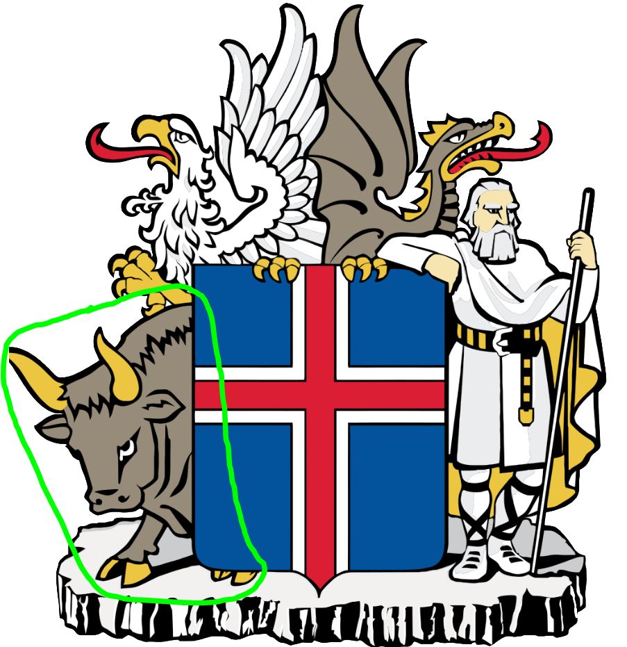
Welcome to the second of my four part Icelandic Adventures series. In this post, I’ll be covering the Northwestern part of Iceland, which is protected by the Bull, or Griðungur as per the native term. So far, the only thing that is bugging me about the protectors is why aren’t they displayed in their relative corners on the coat of arms? But I digress. Today, the post will cover two days worth of the journey, and encompass our adventures along the road from Reykjavík to Grundarfjörður, as well as from Grundarfjörður to Ósar. And don’t worry, I won’t test anyone on their pronunciation of the place names! Technically, the start of the first day is still in the Southwest, and the end of the second day is in the Northeast corners, but it’s close enough!
Album of Photos from Reykjavík to Grundarfjörður
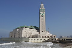
After spending a wonderful couple days in Raykjavik, it was time to hit the open road in our rental car and see what this beautiful country had to offer us! On our itinerary was a plan to follow the ring road around Iceland. To put ring road in perspective, it is basically the ONLY road around Iceland, and I believe the ONLY road which is (almost) fully paved the full way. Yes, you read that right, Iceland is a sparsely populated country with an interior dotted with ica caps, mountains and volcanoes. There simply isn’t enough of a population base or industry to support a conventional road system through the middle. There are seasonal roads criss-crossing the interior, but most rental cars are NOT certified to take them (i.e. you need to be driving a 4×4 even in summer to enter them. This is enforced by police. As such, we mainly stuck to the main road, taking only a few detours off the beaten path. The good news is that there is plenty to see an do on the main track.

First up for us was a visit to Iceland highest waterfall, the Glymur, which was a short drive from Reykjavik. At 200m tall, it is an impressive sight. However, even better than the sight was the fact that to get to it, we’d have to embark on about a 2 hour hike in the wilds. Finally! A little real adventure! The hike was a welcome break from all the planes, buses, cars, and cities of the last few days. The scenery along the way was spectacular, and we were also blessed with sunny skies for the trip. The topography was rolling, with some good climbs, and not a lot of tree cover. Over the days, we’d learn that’s the norm. There are almost NO forests in Iceland. You’ll see one in a future post though. Once at the waterfall, it truly was a remarkable sight. Unfortunately, due to the way it is carved into the rock, it was tough to get good pictures. However, it’s power can be felt all around you in the carved canyon, and being there in person was awesome! We climbed all the way to the top and followed the river for a while. I had hoped to ford it and take an alternate route back down, but that was not going to happen. The water was just a little too cold and too fast flowing!
After our excellent hike and picnic at Glymur, we drove on. Along the way, we learned a bit about the role Iceland played during WWII. Both the British and U.S. Navies made use of some of the harbours as bases and ammunition depots. Given it’s location, it totally made sense.

Naturally, since we’d just stopped at a waterfall, the next logical stop was to head to a dormant volcano. For that, we headed to Grábrók, which had a cool series of walkways leading around two dormant cones to give us a sense of the forces that shaped the creation of this land. For those curious, there was a total of about 500 steps to climb here. This made for a good cap to our physical activity on day 1.
Slightly intriguing to me were the stone remains of buildings that were located by the flank of these craters. It was unclear when they were inhabited or for what purpose. My guess it was for animals grazing in the area, but I didn’t see a full info plaque to explain it to me :-). Sometimes, a little mystery is more fun than knowing the truth though, right?

From the volcanoes, we backtracked slightly in order to take our first bit detour off the ring road. The destination? The Snæfellsnes peninsula, and its associated national park (the Snæfellsjökull National Park) and big volcano (the namesake Snæfellsjökull). I just like seeing those words typed out, don’t you? We eventually gave up and simplly referred to the area as Snufulupagus. The area is often referred to as ‘Iceland in Minitature’, as in this compact area, you can basically see everything that Iceland has to offer from geography and sites.
As the day had already word on, and the sun was already going down, we decided we’d save the bulk of our peninsula exploration for the next day. After all, we decided we needed to rest a little before some nocturnal activities. We had learned that the forecast was for pretty favourable conditions for the Aurora Borealis that night, especially in comparison to the next few nights, we we decided to capitalize on that, and head out late at night to see if we could see and/or capture the stunning light show. While conditions weren’t perfect, it was still pretty impressive, and I did manage to get a few shots. Great way to end our first day of road travel!

The Snæfellsnes Peninsula
True to forecast, the next day broke rather grey and sad looking. No time to dwell on that though, there were sights to see and adventures to take part in. Plus, you never really know if the weather will stay bad, turn sunny, or worsen. You take what you get, and make the best of it!
Album of Photos from Grundarfjörður to Ósar


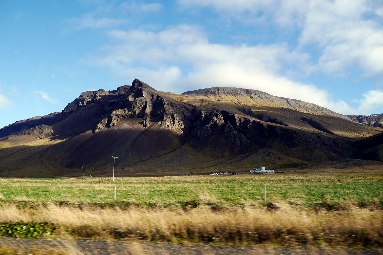
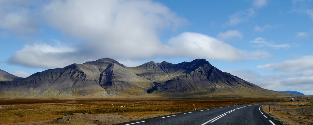
To start our day, we stopped near our hostel to check out the Kirkjufell (Church Mountain). From there, a little way up the road at another roadside info plaque, we learned about Axlar-Björn, Iceland’s most prolific serial killer, who axed down a rumoured 18 people (this was waaay back in the 1500s!). Mind you, he also happens to be Iceland’s ONLY known serial killer! After a rather sombre start to the drive, we continued on our merry way, winding through fishing villages and lava fields, observing the amazing terrain of the peninsula. For some reason, the character of the peninsula was actually accentuated by the grey skies. I’m not sure bright blue skies would have communicated as much about the life people lead in this part of the world. As such, we embraced the mood.
There were plenty of opportunities to just pull off the road and wander around through lava rocks, which was pretty cool. I was particularly impressed at on little spot when we found a full soccer field basically surrounded by volcanic rocks. It was an interesting juxtapostition. Another thing we appreciated with this landscape was that with the distinct lack of trees, all the views are basically unobstructed. So are you are driving, you have plenty of time to enjoy the views of the mountain as you drive literally around them for a long period of time!
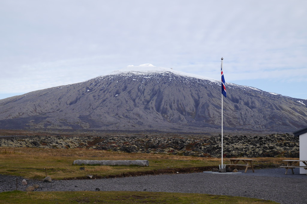
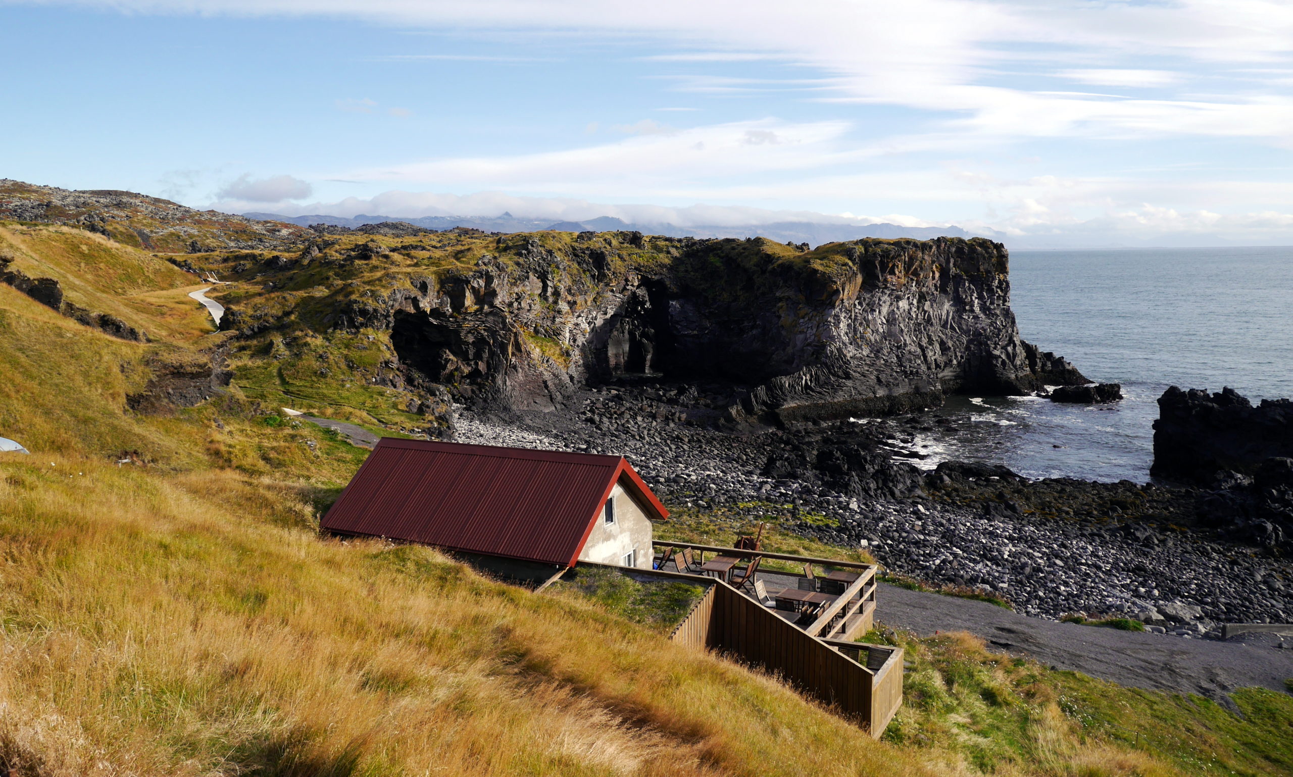
Of course, the actual ‘star’ of the peninsula is the Snæfellsjökull volcano, which we did eventually make it to. In reality, we’d been slowly driving around it for quite some time, it was just partially obscured by clouds and smaller mountains scattered along the way. This is no small fellow though. There would be no stairs to climb this beast. It is in fact a 700,000 year old stratovolcano! This behemoth is more to be seen than clambered on during this trip. For that, we stuck to smaller volcanoes, such as the Saxhóll crater, a mere 100m high. Feel free to check out the pics of that bad boy by checking out the album above. Honestly, there were just so many amazing sights that you really should click through them. Plus, if you do make it to Iceland, we HIGHLY recommend adding the peninsula to your trip. It was absolutely worth the detour.
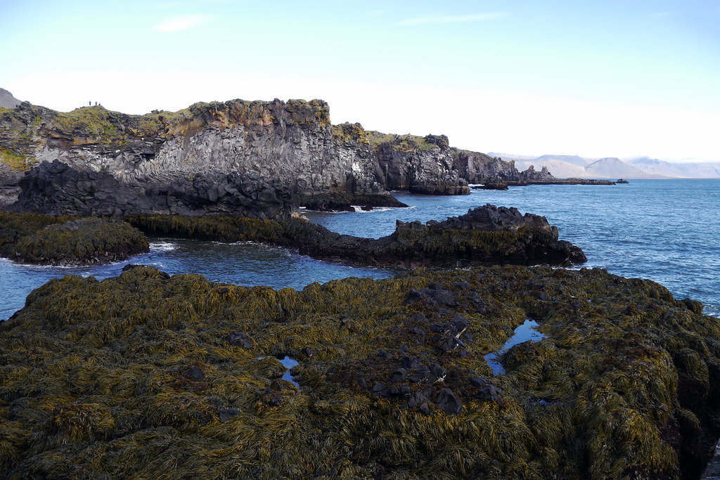
Sights such as the ‘troll rocks’ spring to mind. Also, here you will find a the Vatnshellir Lava Cave that you can go spelunking in if you are so inclined (for a fee). We even found a great little park along the water with a zip line to play on, all with the big volcano as a backdrop on one side, and the crashing ocean against lava rock on the other! Finally, to close out our time in this area, we went for a great waterside hike near the village of Arnarstapi. Places like this were also ideal to have our daily ‘picnic’ of sandwiches and snacks to fuel us. The drive continued for another 30 or so kilometers around and out of the peninsula, but I have to move on narratively (I know, that’s not a word!) to the next part of the day!

And so it is we found ourselves heading every northwards to new terrain, and deteriorating weather. For a reason I can’t quite remember, other than possibly the hostel location and/or another cool landmark, we took another detour off the road. This time, it was a real detour, as we were heading onto a dirt track towards the ocean, and around another small peninsula (the Vatsnes Peninsula) to get to the village (hamlet? enclave?) of Ósar. Honestly, I think that was just the name given to the collection of houses where we ended the day. This trend was repeated daily as we headed to places that had names on the map, but didn’t really ‘exist’ in a conventional sense. Getting back to this ‘road’, it was honestly probably one of the most nerve-wracking drives I’ve made in a rental car given all the humongous potholes and mud holes. On paper, it was about 50k, but took us nearly 2 hours!
The silver lining to the lack of actual facilities and civilization was the feeling of total freedom. This was made all the better by the abundance of clean drinking water. I know, that’s a weird thing to say, but it was great to be able to pull off wherever we saw a trickle of water in order to fill our water bottles (provided livestock weren’t lurking nearby).
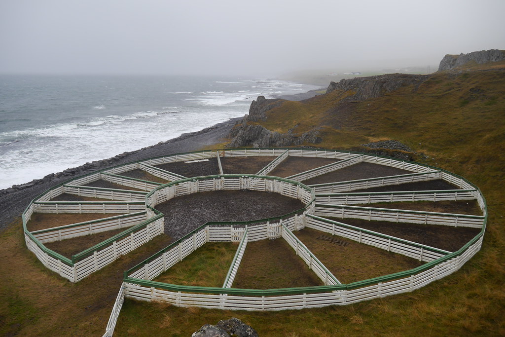
Another plus side of taking the side road, aka cow track, was the fact that we did get to see a few unique things such as the livestock sorting corrals that they use in these regions to sort animals. All the area farmers can freely let their animals roam, but if things are getting dicey, and they have to round them up, they work together to get them all into these sorting areas to figure out which animal belongs with which farmer. I thought it was a very aesthetically pleasing structure.
Eventually, we arrived at our destination, happy to finally be off the rough road and the relative safety of our hostel. This really just turned out to be a farm building, with the owner out tending to his farmer duties, with a note letting us know where to go. As it turns out, a large part of the tourist economy is also practiced by locals with other duties, such as tending to family farms. At certain times of year, the priority is the farm, not the people. This may have been one of those times :-).

Regardless, we settled in quickly and made our way on a quick walk to the nearby beach to catch one final view of a neat geological feature before turning in for the night. As it turns out, this whole peninsula is a protected area for seals, and is home to the largest colonies of seals on the island. But, we didn’t see any of them :-(. I guess on gloomy days they prefer to stay in the water and find food rather than lounge on the rocks. However, what we DID get to see was Hvítserkur, a 15m high basalt rock formation, basically across and just down the road from our hostel. Supposedly it is said to resemble a dragon drinking. Sadly, the light was fading fast, so I didn’t catch a very good image of it, but it was still pretty cool!

So ends the second full day on the ring road, and our exit from the Bull and into the domain of the Griffin, which we will explore more in our next instalment! Thanks for sticking around. Hopefully you are enjoying these little tales and images from a world away. We may all currently feel like we are worlds apart, but a trip to an isolated place like a remote peninsula in Iceland does show us that even though we may be apart, we share a common life, and a common struggle to overcome, no matter what! See you next time!