After spending the first four days of the “O Circuit” in Torres del Paine mostly in our own little bubble and circle of co-trekkers, we were about to change gears slightly. Starting on Day 5, we would be joining up with the “W Trail” at Torres del Paine. This is by far the more ‘popular’ route at Torres del Paine, but in my opinion, only due to the fact that you can get the best sights the easiest on this route. While the O is all about self-reliance and a serious trekking option, the W caters much more to the tourist crowd, guided groups, and the well-heeled who can hole up in luxury cabins along the way. That’s right, most of the overnight stopping options have full refugio options with beds, showers, hot food, etc. This is thanks to the much easier re-supply options as many of these sites are accessible by boat from roads. While still somewhat wild, it is much more civilized. Read on to learn about our next couple days on the circuit!
Day 5: Paso to Paine Grande


Day 5 ended up being our longest hiking day of the circuit, at (only) over 20 km. Although I’m used to trail ultras that are easily upwards of 100k in one effort, the game is different when you are trekking and carrying a pack with everything you need. That being said, we never found any single day particularly taxing. After all, this was vacation, and meant to be enjoyed, not endured! This day was actually split in two sections. The first was Paso to Refugio Grey, where the O Circuit merges into the W, which starts here. The second section was Refugio Grey to Paine Grande. The only reason we did both sections in one day was that we couldn’t get reservations at Grey. The upshot was that we chose to use the end of this day as our ‘luxury day’ to celebrate our wedding anniversary belatedly. We booked a bed and meals at Paine Grande! After all, this was our 5th wedding anniversary gift / trip to each other!
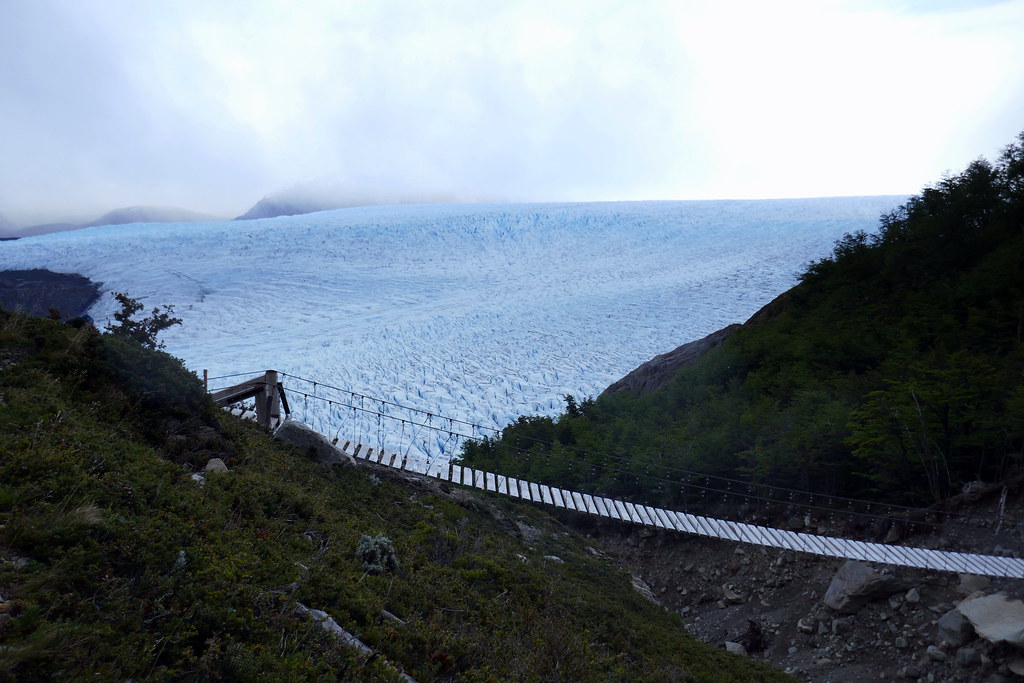
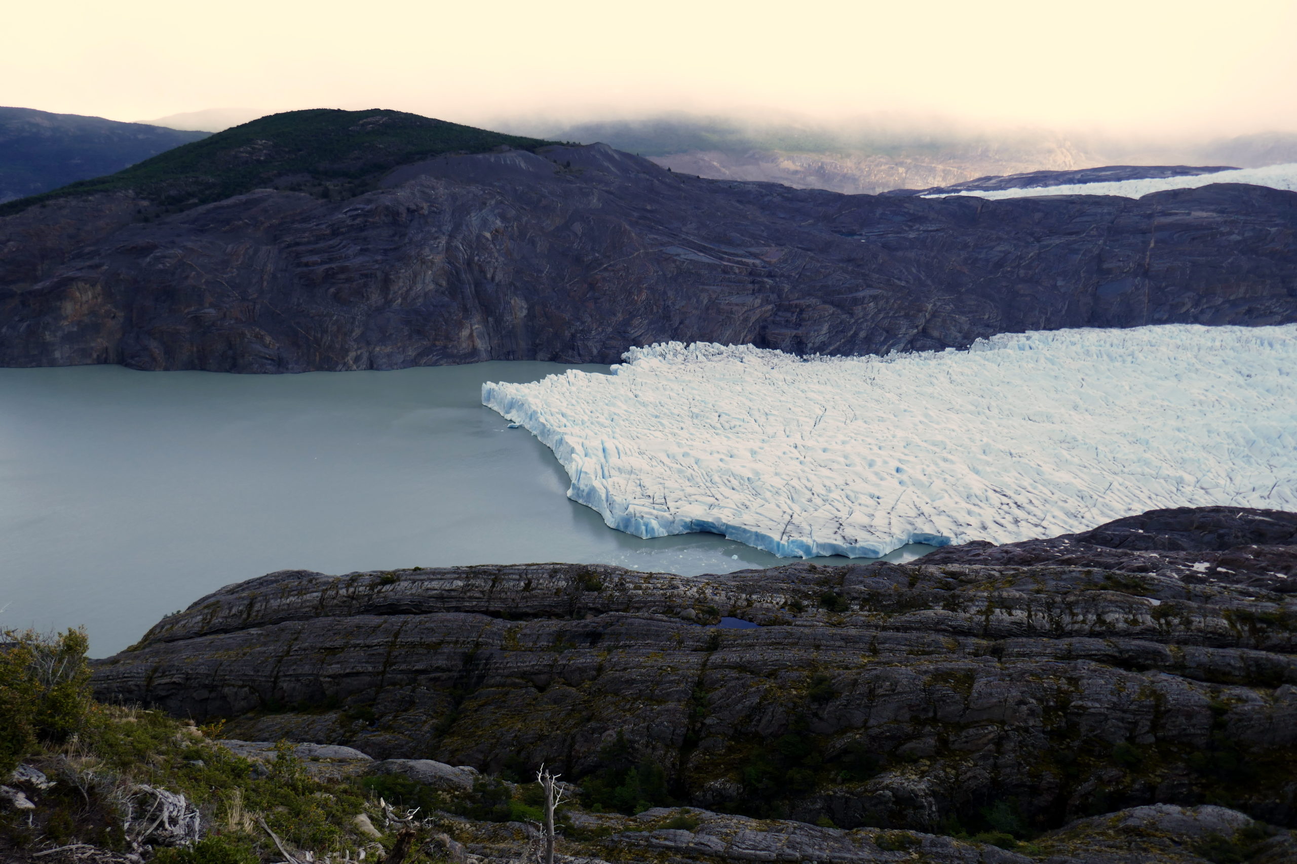
The entire route from Paso to Refugio Grey was spent meandering along with the Grey Glacier directly below and to our right. It was a spectacular trekking section. however, it also featured Deanna’s least favourite feature. Yes, even worse that horses. It was a trail with some pretty amazing swinging bridges to cross. I absolutely love them for how they insert you into the surroundings, but Deanna did not share my giddiness, although she did eventually come to terms with them. I believe there were three major ones, and by the third, I’d convinced Deanna that we could both be on at the same time, and that she could pause for me to take a picture of us both on it 🙂
Besides these bridges though, the views were just absolutely breathtaking. We took our time on this section, knowing some of the best views were here, and also slightly dreading getting on a path where there would be much more traffic (now including 2-way traffic, as the W can be done in either direction).
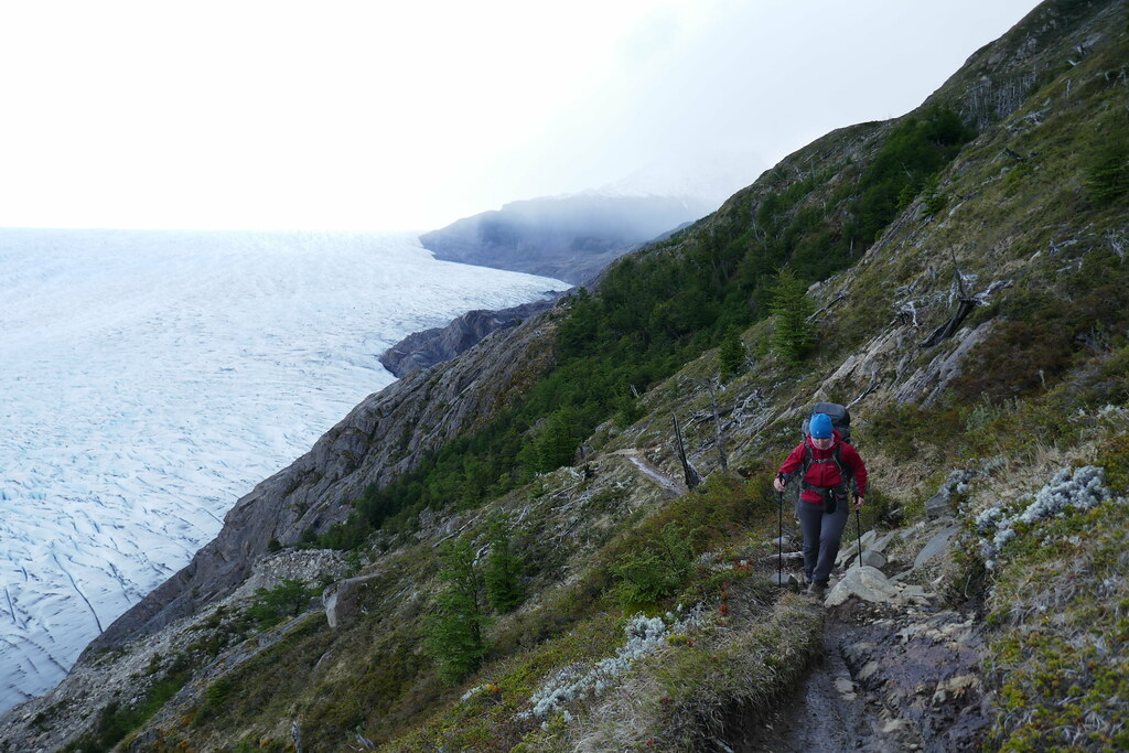
Before arriving at Refugio Grey, we made our way part the terminus of the glacier. From here, this massive hulk of ice and snow feeds its namesake, Lago Grey, a major lake popular with all sort of sport, including kayak tours to the glacier terminus as well as the many little harbours along the way which often hid little baby bergs.

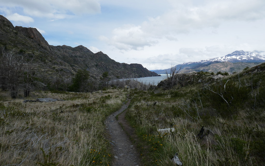
Once at Refugio Grey, we took a nice lunch break. We took off the pack, and even made some nice warm soup rather than just having our standard sandwich and cookie lunches with tail mix. We also wandered to the nearby waters’ edge to look for small icebergs. Instead of seeing a lot of these, we faced the wind. The remarkable wind! It was heavy here, but NOTHING compared to what we’d face in a a short while. From here the trail continued to follow along the lake in a generally Southeast direction. The trail became a fair bit wider, with many spots featuring double tracks where different groups could more easily pass each other in different directions.

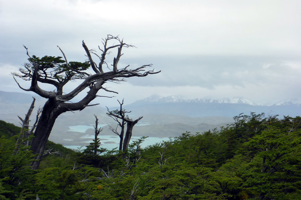
Our trail eventually took us through the remains of a forest fire area (trees here take a VERY VERY long time to grow back). It was left as is to remind people of the cost of negligence, and the fragility of the ecosystem we were fortunate enough to be in. Fires of any kind are MAJOR no-nos in Torres del Paine, with very hefty fines for anything more than using a camp stove in a designated shelter. After, this we headed uphill in order to skirt the mountain and the lake. It was at the top of this area where it really hit us. The WIND! It was the 3rd of 4 spots marked on the map, and the absolute rawest power we experienced. At times, I had trouble walking forward in areas that were exposed. The gnarled trees illustrated all too clearly the prevailing winds, and the strength they possessed in order to be able to grow in these conditions.
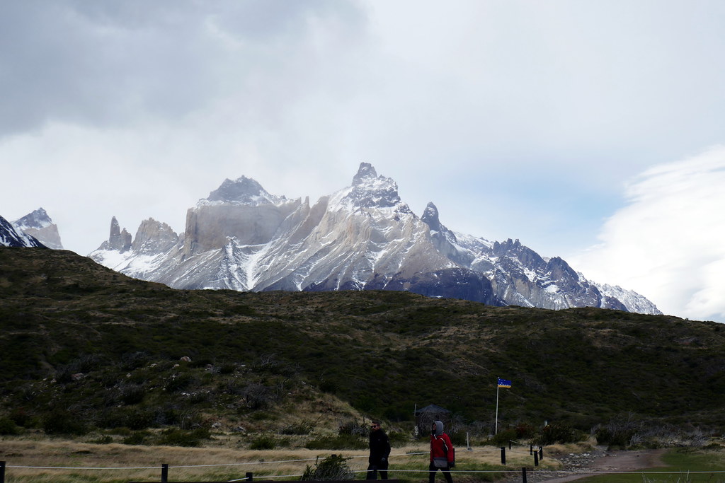
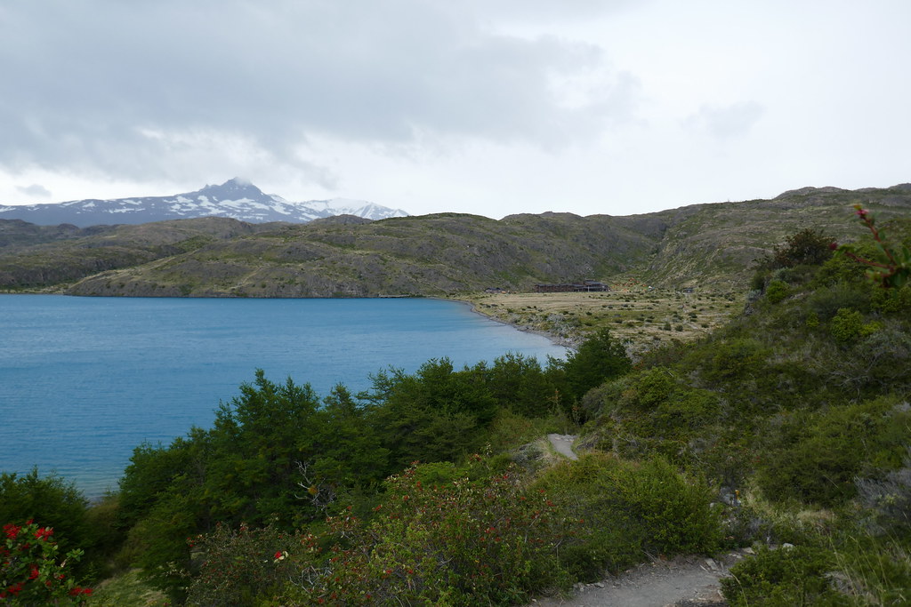
We were quite relieved when we finally spotted Paine Grand in the distance, along with a very white-capped Lago Pehoe, showing that the wind really was the boss here. Upon arrival, we got set up in our bunks in a dorm, had warm showers, and spend WAY too much money on 2 beers and a bag of chips (which we rationed for 3 days!). But it was heavenly. We wandered outside to see many hikers struggling mightily to set up tents in the roaring winds. We realized choosing the dorm tonight was a solid idea for more than one reason; our tent would survive the night, unlike some others that were poorly anchored that night! The other nice part of this night was that during our even stroll, the clouds parted, and we were treated to some amazing early views of the mountains we’d been slowly going around for several days now.
Day 6: Paine Grande to Italiano
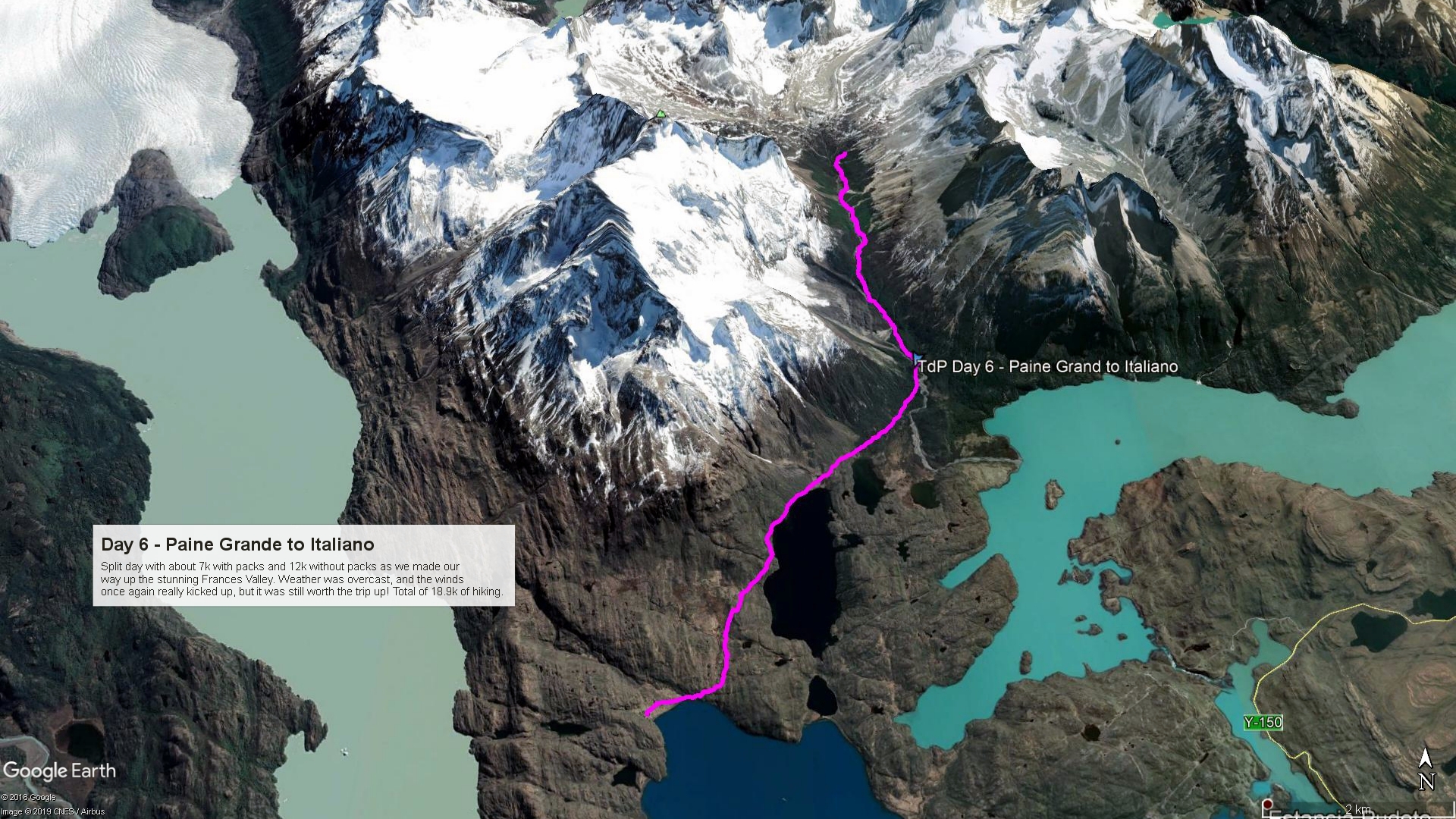
After a great nights’ rest and extra fueling from the kitchen prepared meals, we left Paine Grande with a spring in our step (and fresh fruit!). As we’d passed the midway point in the trip, our packs were lighter, our experience had risen, and we were in our element now. Today was a shortish 7k hike to our next campsite (forced due to reservations). However, that short hike was tempered by the additional 12k side trek we’d be doing up the famous Frances Valley. From the Italiano Camp, where we’d spend the night, we could drop our packs after setting up the tent, and head up the valley unencumbered, and with a nice picnic packed in my day pack. As far as the weather went at the get go, it was another grey, cloudy, day, threatening rain, and lots of wind to push us around.

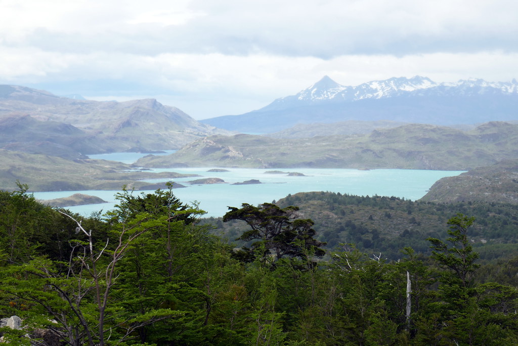
The trek from Paine Grande to Italiano was rated ‘green’, so a pretty easy route overall. As far as elevation, it was a gradual climb the entire way. Our general views were a mixture of rolling hills, lake views, and plenty of cloud-obscured mountains playing coy. Our newest addition to the journey were the additional crowds of hikers. We were faced a few times at the prospect of passing large groups of day hikers. With no packs, and very overdressed, these groups were typically quite a bit slower than us, even with our packs. We played as nice as we could, but really had to get around them for our own sanity.

Owing the to the short distance, we found ourselves arriving at Italiano within about an hour and a half. The arrival was marked by a bridge crossing. On this particular bridge, only a single hiker could cross at any one time, so there was a short wait as people gawked at the view from the bridge, which was admittedly an awesome view. Then, at the ranger station, a TON of hikers were dropping bags off at the station to head up the Frances valley. Most of them were camping further down the trail. We’d opted to camp here overnight, not only because it was ‘free’, but also because it was all that was available. On the plus side for us, it was more like the O circuit camps, and VERY basic, just the way we liked it!
The Frances Valley
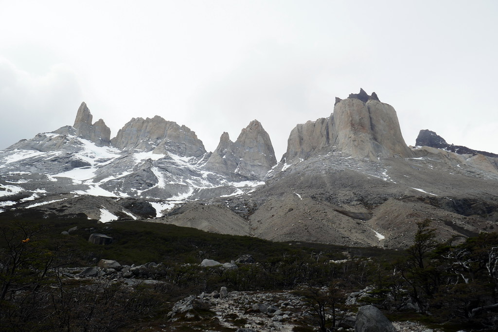
Honestly, the hike of the Frances valley is worth its very own section. This hike is described by some as the jewel of the entire Torres del Paine park. The actual hike to Las Torres (in 2 days hence) is the better known for its views, but Frances valley most definitely gives it a run for its money. After pitching our tent and covering up our big packs, we set out with our daypacks. We were warned in advance that conditions were ‘variable’ and could easily move into dangerous territory today, but decided to head up anyway. After all, we were only here once. We decided if things got dicey, we could always get up early and try again the next morning if needed.

In case you hadn’t figured it out, the Frances ‘valley’ isn’t actually a flat valley hike. The reality is that this entire hike is a tough uphill slog to arrive at a few viewpoints where you get treated to near-unobstructed views of the hanging Frances Glacier as well as the backside of several very notable granite peaks that feature prominently in the Torres del Paine national park. As we slowly progressed upwards, the weather was indeed quite threatening. The ever-present wind picked up to fever pitch a few times, leading us to wonder whether we should turn back or now. Each time, we re-evaluated, and decided to press on. Our picnic was particularly interesting, as we had to crouch low to get some cover, lest we want our food to literally blow away!
Regardless of meteorological conditions, the hike was well worth it, and the upside of touch and go weather meant less hikers than we might normally have encountered, given the challenging terrain.

The one upside of the wind was that every now and again, it would blow sufficiently to open up a pocket of visibility to the surrounding mountains. This made things feel even more special, as we’d only get to see the views if we were lucky and patient.

And patient we were. Choosing our steps carefully and deliberately, we eventually made our way to the Mirador Britanico. At one point, there was a campsite up here, but it had closed a few years back, so the only way to see the views from this area now are to make the 12 km round trip trek as part of your overall itinerary. I had carried both of my cameras up with me, uncertain whether we’d avoid the rain or not. As luck would have it, I managed to grab just a few shots at the top of our hike before the first raindrops hit. How fortunate!
Not wanting to press our luck too much, we decided to turn around and head back down before things went sideways. Knowing the trail we’d have to return by, we didn’t want to risk trying it if some sort of flash flood materialized up here. After all, it was spring time, and weather and water conditions can change quickly. We’d definitely got what we hoped to out of the Frances Valley, and were content to head back to base camp to try and warm back up, and make sure our gear was still secure and dry. We were surprised a few times by the number of people still heading as we were making our way down. Deanna and I were quite fast heading up, and on our return, it was already getting later in the day. We didn’t think there was ANY chance these people would make it safely up and back before dark. Good thing people have to register with the rangers!

We arrived with a little positive experience. The rain actually held off! The wind was still present, but given the shelter of the trees, it was relatively mitigated near our tent. That meant that we’d actually be able to try and dry a few things before it got too late. It’s a bit tiring to always be putting on wet socks and boots! We just had to make sure things were fastened securely to branches, otherwise, they’d drop right into the dirt below. Ah, the little chores and challenges that make a trip like this so fun, amiright?
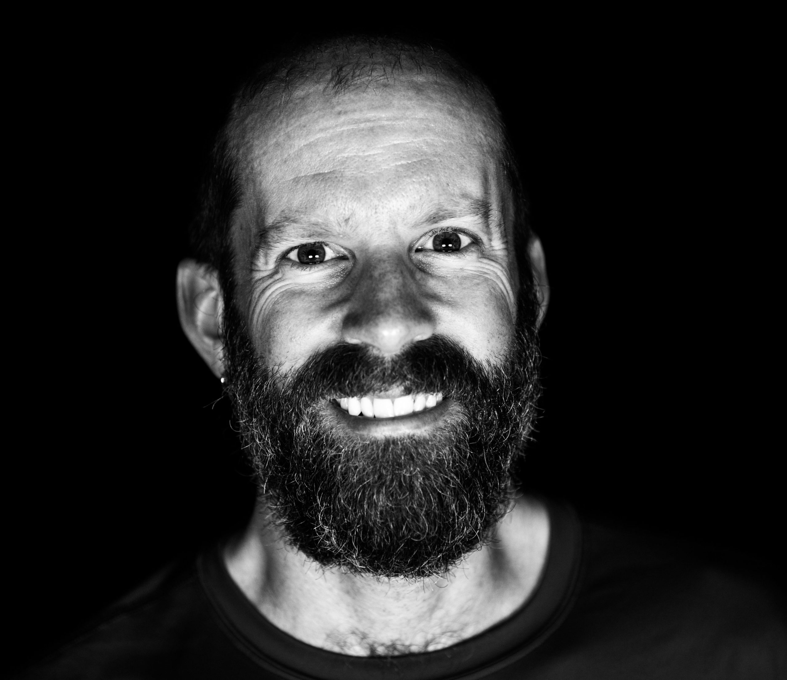
Speaking of fun, another highlight of these trips are simple pleasures like a nice warm cup of tea at the end of the trek for the day. Below you’ll see master chef Steve preparing our Mint Tea and the rationed chips from the day before that we’d enjoy for a late afternoon snack before I cooked supper for us. All in all, another great day in spite of the weather!

While I was thinking of writing only 2 posts for the circuit, I can see that is foolish. This post is already long enough! As such, please join me in my next post where we wrap up the O Circuit, and take you to the most famous of those Patagonian views, the Torres del Paine! Will the weather cooperate? Will the wind blow us off a cliff? Will we even SEE the mountains? We had no idea at this point, and anything could happen. Come back for the exciting conclusion of the trek!