After spending over 5 total days basically in transit, it is finally time for this story to take us into the actual wilds of Patagonia. My next three blog posts will focus on our trek around the Torres del Paine National Park. This was the main goal of our trip, and what we’d been planning meticulously the past few months. In our case, we had decided to tackle what is known as the “O Circuit”, as it basically circumnavigates the entire main mountainous areas of the park. While the hiking itself overall wasn’t super complicated, the same can not be said for the logistics. Date-specific permits are required for the entire trip, as are mandatory camping reservations. However, these must be acquired by dealing with 3 different companies operating sites, and you can’t start until you prove you have legit permits for EVERY night. It was a nerve-wracking affair, as many sites sell out very quickly. Read on now to learn about the first half of the circuit (the ‘back half’).
Day 1: Laguna Amarga to Seron

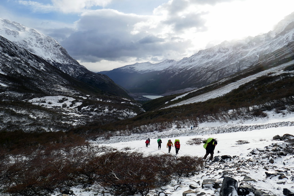
Another thing to note about the O Circuit is that it can ONLY be done in one direction, which further complicates reservations, as depending on the day you start, you could be stuck with no lodging at any point in your trip, especially on the second half. Why is that? Well, the second part of the trip becomes the more touristy “W Circuit”, which can be done in both directions, and is therefore even more busy. But that is for another post, as in this chapter, we were starting out on the very quiet back half. There is a strict limit on the number of daily permits, and these are frequently checked along the way. We were attracted by the promises of not many people and a real rugged experience. While there are many traditional ‘hut/shelter’ lodging options on the W trek, the O is more rugged and requires at least SOME tenting. For our part, we’d decided to tent the entire circuit (although I had planned for a ‘luxury’ night mid way around).

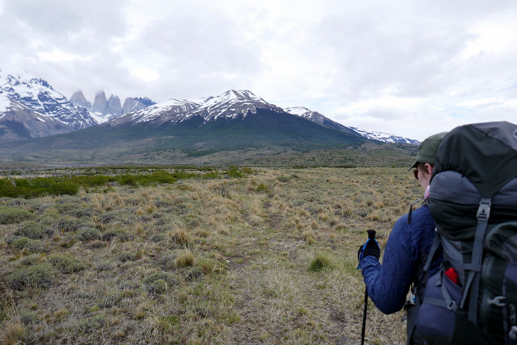
Day 1 broke as an overcast day. After a bumpy 2+ hour bus ride, we found ourselves at the Laguna Amarga park station. This is where we unloaded our packs from the bus and started our hike… ALONE! Many people doing the O Circuit don’t realize you can start here, and instead head to Hotel Las Torres to start. Our chosen route was a little longer this day as a result, but spent almost entirely on a track completely alone. It was great! Although admittedly seemed a little odd as we struck out, and the bus pulls away continuing down the road with EVERYONE ELSE still on it. Deanna was a little apprehensive, but I assured her I knew what we were doing. At least one of my maps showed a trail starting near where we stood. For possibly the first time in my life I truly felt like I was on a proper expedition. Fully isolated and self reliant. This was a cool feeling.
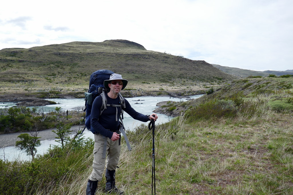
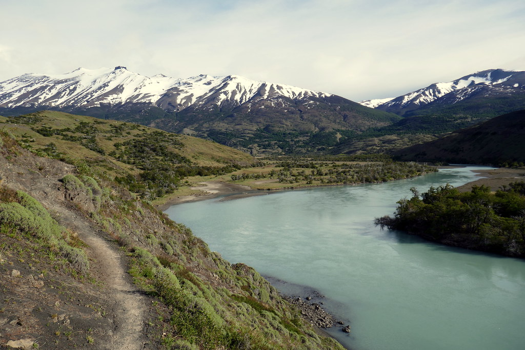
For the most part of our 16.8km first day, we followed relatively flat grasslands. The trail snaked along beside the Rio (River) Paine, intermittently giving views of the Mountains we’d be skirting the entire circuit. At a few points we got glimpses of the magical Torres del Paine (the Towers), which are the main highlight of this park. Sadly, with the cloud cover, much of the time, they were obscured. We were hopeful that a week later when we’d actually get there, we’d have some clearer skies. For the most part though, our spirits were light with this first day. The idea today was to get comfortable with the weight of our packs, and find the pace that we felt most comfortable maintaining for days. We also used this day as a chance to figure out if we’d made the right clothing choices for socks, layers, etc. The lessons we quickly learned was that even if it starts cool, jackets were not required for the most part. For me, I also learned that as cool as the long gaiters looked, they were mini sweat boxes! But, they DID keep my pants cleaner, so I opted to keep them on.

Eventually, our grassy trail merged with a much-more travelled track. This is where every other hiker had chosen to trod, as well as horses. Compared to the solitude we’d experienced for the first few hours, this track felt like a highway, as we saw actual people! Not a lot, but still… Apparently this track is often used by some as a day trek only, as they will go to the first camp, Seron, and turn back, or spend one night and return. It is a trip that can be done by horseback. Funny observation that I made on this part of the trail. Deanna apparently suffers from a mild form of Equinophobia, meaning a fear of horses. She was not too thrilled when we had to pass by a few of them in close quarters. She was also constantly paranoid that they were giving her the stink eye and plotting against her.

Luckily, we made it through unscathed by our cloven hoofed friends, and eventually made it to Camp Seron, our first stop of the journey. Our daily plans were to always be done trekking by the mid afternoon, so that we could set up camp, do some exploring, and air out / dry things if we needed to. Our strategy changed slightly as we proceeded though, as we learned the early bird gets the better tent sites. As it turned out, that was easy for us, as we were quite a bit quicker than most other hikers on the trails. We would often leave after most hikers, but always seemed to pass them fairly early in our daily hikes. At any rate, Seron was a nice fielded camping area with a reputation for getting windy. Good opportunity to figure out the best way to set up the tent in winds, a skill that would pay off. I had added numerous extra guy lines just for that purpose.
We ended our day with a feast of instant mashed potatoes with sliced sausage in it, along with warm cups of coffee (Deanna only), and some nice mint tea (my personal favourite when trekking and in mountains). Thank goodness we’d bought a big ‘bag’ of mayo, as it turns out may works as an excellent butter substitute! And powdered milk is also very handy for cooking. The plan was to consume much of our ‘heaviest’ foods as early as possible, to lighten the load. After a nice post-meal stroll, it was off to bed to dream about the next day.
Day 2: Seron to Dickson
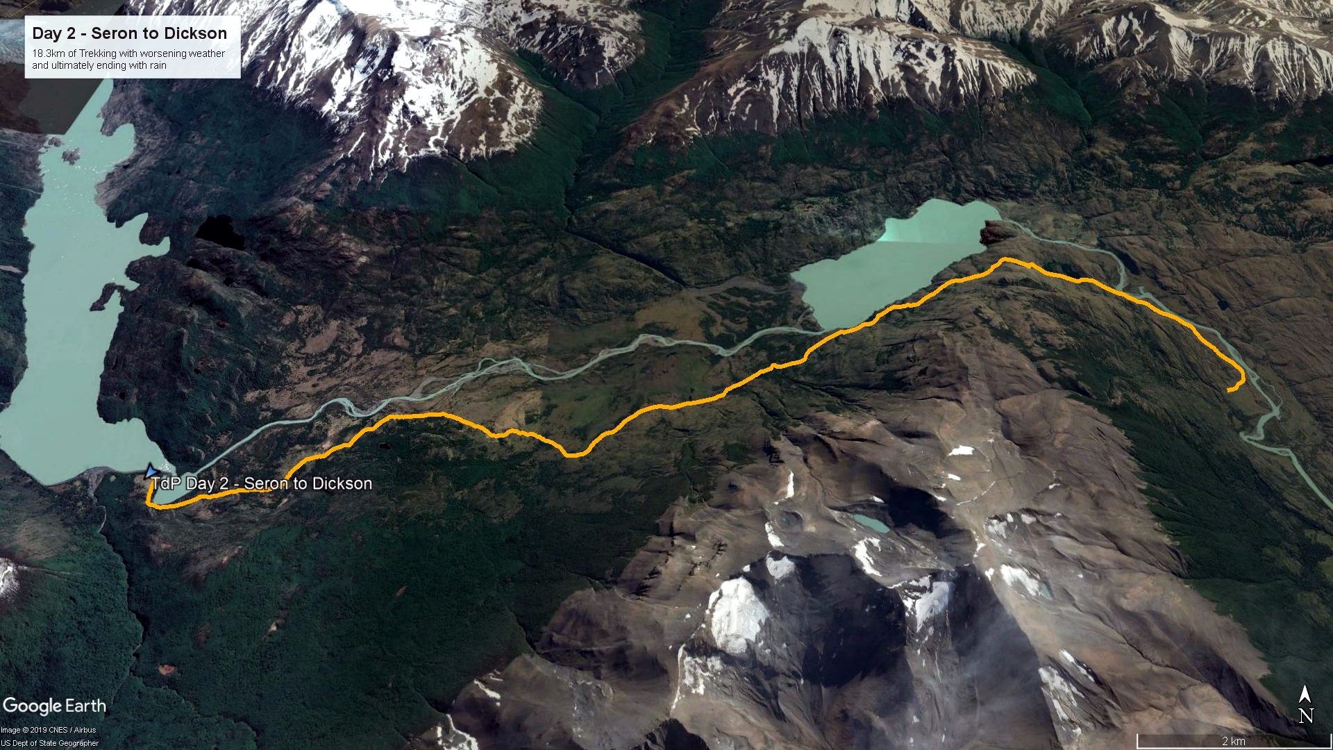
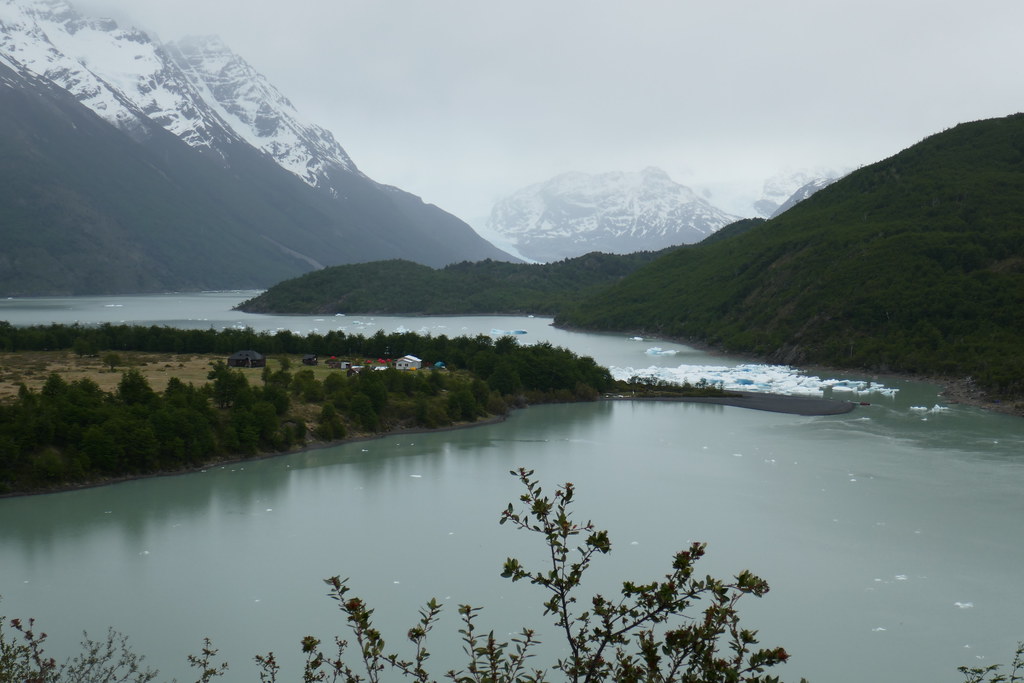
Our day 2 journey would cover over 18km of terrain, taking us to the stunning Dickson campsite. As you’ll see in the map above, we were once again following along water features for most of the day. This included passing by Lago (Lake) Paine and finishing off at Lago Dickson. Lago Dickson is a glacier-fed lake (as are most around here), but situated literally at the base of two glaciers, Cubo and Dickson. As a result, the calving action of those glaciers can lead to mini icebergs making their way to the camping area. We started our day once again with a bit of overcast skies, but hoped for the best (and chose to skip jackets knowing we’d get warm as we started out. Porridge and tea to provide a little fuel in the belly, and off we went! The first part of the trails today felt quite similar to yesterday. Mostly grassy plains, with a clear track to follow, and even the occasional trail marker assuring us we were on the right track.

After a short while however, we mad a bit of a left curve, changing from north-bound to west-bound, and things changed rather dramatically. We crested a little hill, and before us lay Lago Paine. It was a very pretty view, but the WIND! It was like someone turned on the wind tunnel to maximum. Looking at one of the maps I had, there was even a small warning icon at that spot showing strong winds. It was one of only four such spots on our entire route. We had to hastily retreat in order to ‘batten the hatches’ by securing hats to heads and throwing on wind jackets. It was really nutso! More than anything though, we just laughed about it. This is the whole reason to do something like this: see things you’ll never see again, and push yourself out of your comfort zone. Once bundled up, we proceeded on, leaning heavily into the wind to keep our footing on a rocky section.

After passing by Lago Paine, it was just a short hike to get to a ranger station at Coiron. Here, our papers were checked, confirming we had both trail permits as well as camp reservations. We also opted to take a little break here and have an early lunch, as it was well protected, and we almost had a bit of sun. Looking at the log book, we were the 2nd people to arrive there on the day, even though we were nearly the last to leave the last campsite. That was the day we realized we’d be able to have ‘easy’ mornings and still get to camp early in the day. The ranger at Coiron was very friendly. They basically live in little shelters for a week or two at a time, hiking in and hiking out for their shifts. I imagine it can be both amazing work, and lonely work, but you do see new people every day.
Ultimately, our choice of stopping for lunch at Coiron was a good call. Shortly after we set back off, the skies completely clouded in, and we were gifted some rain showers to add a little challenge to the latter part of our trek. Nothing too heavy at this point, just heavy enough to put on rain jackets, and wonder about the tent set-up at Dickson. We were actually well equipped for all weather, so not too much to worry about. All gear was in waterproof pack liners in our bags, with extra dry bags for critical gear. In addition, we’d brought extra-thick garbage bags to cover our packs at night, since they stayed outside (our tent was barely big enough for both of us to sleep in!). Pro tip is to buy the really thick industrial bags. Even so-called tough garbage bags will tear too easily. Nearing the end of the day’s trek was both the highlight and lowlight of the day for us. Highlight for the amazing views along the trail, lowlight because of the rain, and because Deanna’s foot was throbbing (there is a really good story about why, that I’ll save for another time….).
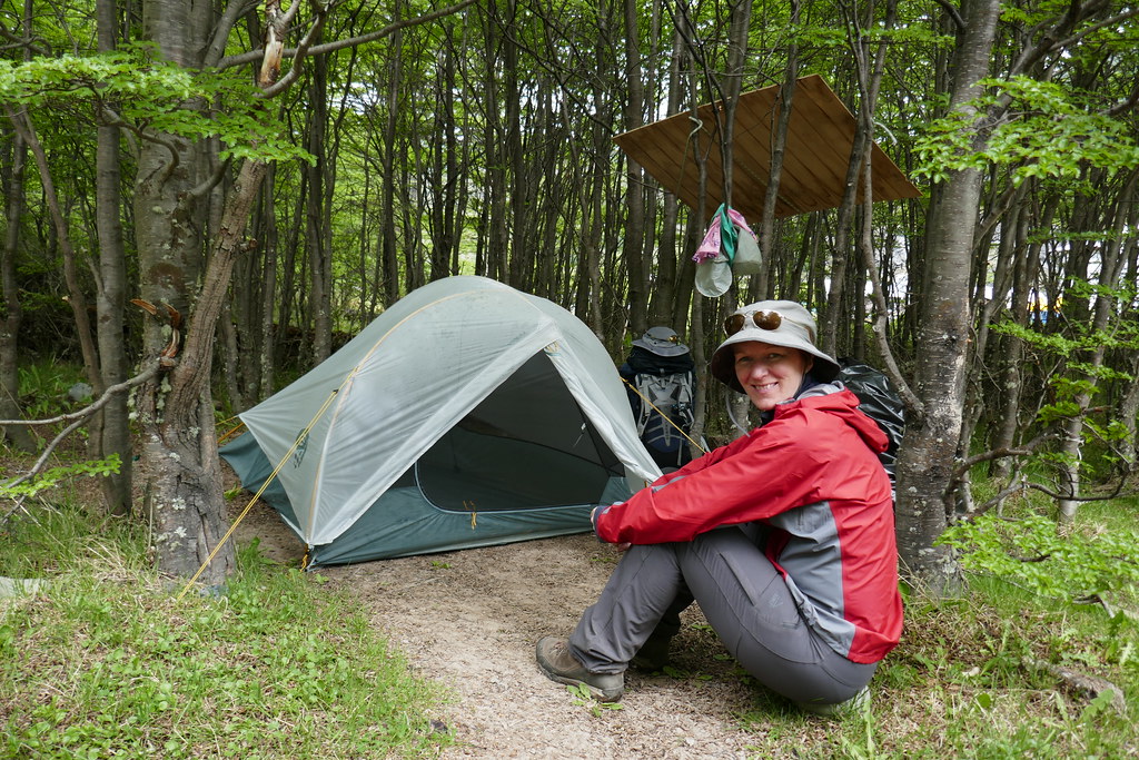
Upon arriving at Dickson, we were given the run of the site as far as tent locations go. We took our time exploring all around to find what we thought might be the ideal spot. We chose a spot a little secluded in the woods with a bonus ‘roof’ where we could stash the packs underneath. It was also near a trail leading directly to the iceberg-dotted Lago Dickson. I set up the tent in the rain, only to have it stop about an hour later. Most hikers who arrived later had much better conditions for their setup. Oh well. At least we’d arrived early enough to be treated to the option of a lukewarm shower in the cabin at no charge! We took advantage, as we knew there wouldn’t be many shower options in days ahead.
Once again, we capped the day off with a tasty supper of what I believe was some warm soup, a freeze dried meal, and coffee / teas. With lots of time before bed, we took a really nice walk along the shores of Lago Dickson, marvelling at the little icebergs dotting the water. We eventually went to bed with full bellies and smiles on our faces.

Day 3: Dickson to Los Perros

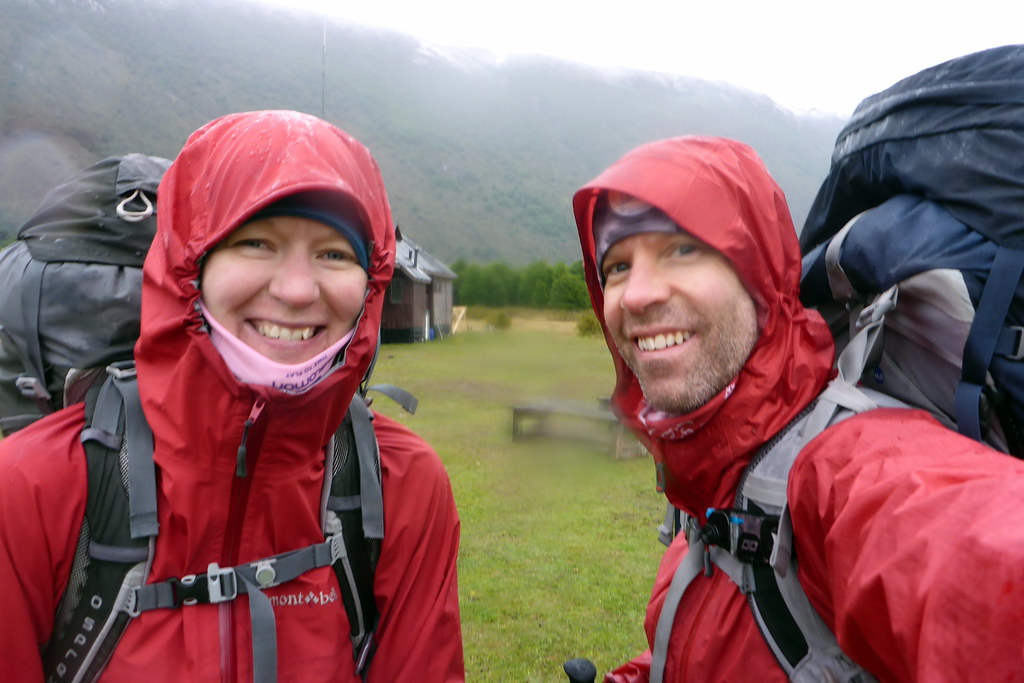
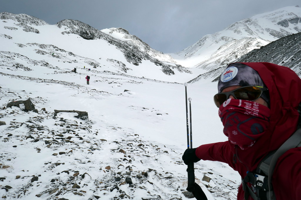
The trick to a good expedition or adventure is smiling in the face of adversity. Day 3 would turn out to be the roughest of the entire trip, and definitely a test of our intestinal fortitude. We awoke to a steady, cold rain, and the rest of the day would feature this rain in varying degrees of severity coupled with winds, and eventually… snow! We warmed up with breakfast, and put on most of the layers we had, skipping the down jackets to have something to look forward to! The picture of us at the start shows us embracing the adversity. Attitude is everything, and with good spirits, we soggily headed off on our 15.5km trek, most of which was uphill this day.
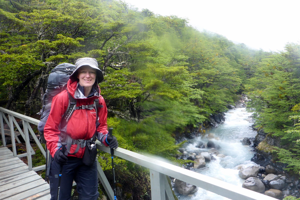
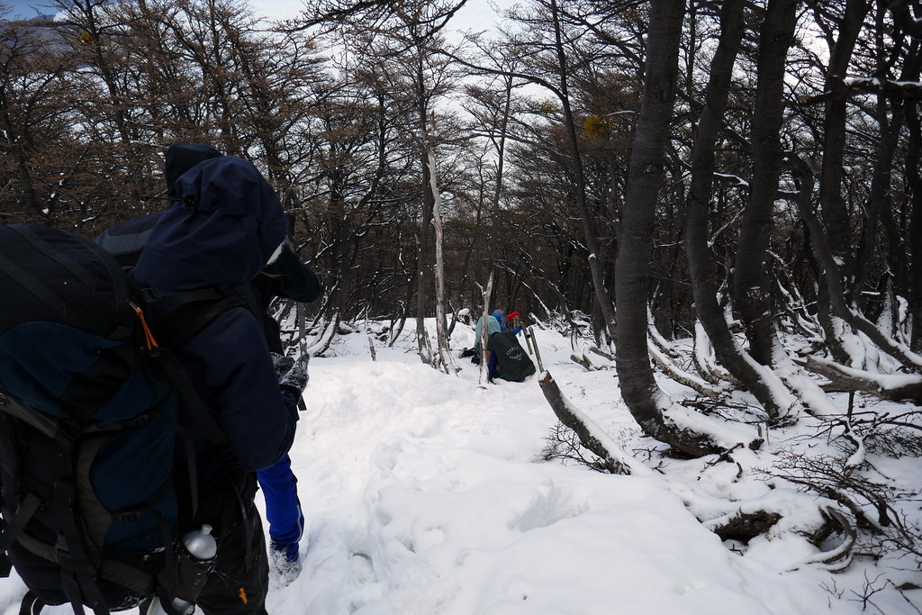
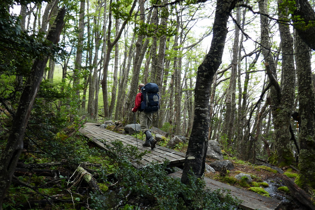
I believe this was the only day that I opted to only carry my waterproof camera along the way. As you might have guessed, I was carrying more than one camera on the trip. In fact, I think I had three different cameras. So if you haven’t done so, you really should look at the albums of pictures on Flickr. I carried extra weight just so I could share my views along the way with you all! :-). The trail started by an uphill scramble through the woods, with some bridge crossings, and eventually following along the Rio de Los Perros for a long stretch before the final long climb up to Laguna los Perros. Footing at times was a bit trickier today than the other days. We had slick roots to contend with, as well as wet rocks, and general muddiness. We made through it all with flying colours though, and soon found ourselves face to face with the los Perros glacier in the distance.
At this point, we made a slight detour and followed a trail to get closer to the glacier and see what the fuss was all about. The whole lake area was strewn with massive boulders and moraine run-off caused by the glacier. As I was goofing off around some boulders, we heard what we thought was thunder cracking in the distance. But I remembered hearing this sound years ago in the Rockies. It was an avalanche! I managed to get my camera out in time to capture the end of it on a short video I posted on Flickr. There is nothing more awesome than the power of mother nature. Later in the evening we returned to this area to see some amazing winds whipping the water on the lake surface into mini water funnels. Sadly, it was a bit too tough to get a good picture of that.
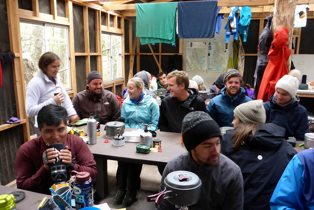
The Los Perros campsite was the most cramped we’d seen so far. I think they were a bit pressed to find a relatively safe year-long spot in the area, safe from the high winds and/or avalanche danger. As a result, we were in a small wooded area well flattened-out by many campers. We had a bit less choice of spots this time, as there were already a number of hikers here. Our next challenge was Paso John Gardner, which hadn’t been open recently, causing a backup. Luckily, after chatting with the ranger, we were told that provided we left early enough the next morning, we should be able to cross the pass, which is the single trickiest part of the entire circuit, and where you can definitely get stuck. We took solace in that fact as we set up the soggy tent. Afterwards, we retreated to the communal cookhouse for a short break from the cold and wet with other fellow hikers. It was overflowing in here, everyone elbow-to-elbow, but in good spirits as they prepared warm meals.

After supper, we had a very brief reprieve from the rain, so we headed out for another little stroll to help digest. On our walk, we even had a little break in the clouds, giving us some great vistas. Included in those views was a pretty good view of what we didn’t quite realize was the pass we’d be trekking the next morning. We knew that tomorrow would likely be the biggest challenge, so we talked a bit about our game plan. Noting the biting cold, we also decided to try and double up in my down sleeping back. Outcome: not great. This is why not 2 months later I would gift us with an amazing 2-person down bag and 2-person sleeping pad for future trips. We spent a pretty restless night, intermittently falling off sleeping pads and/or being cold. Thank goodness we had a rationed Snickers bar to raise our spirits!
Day 4: Los Perros to Paso


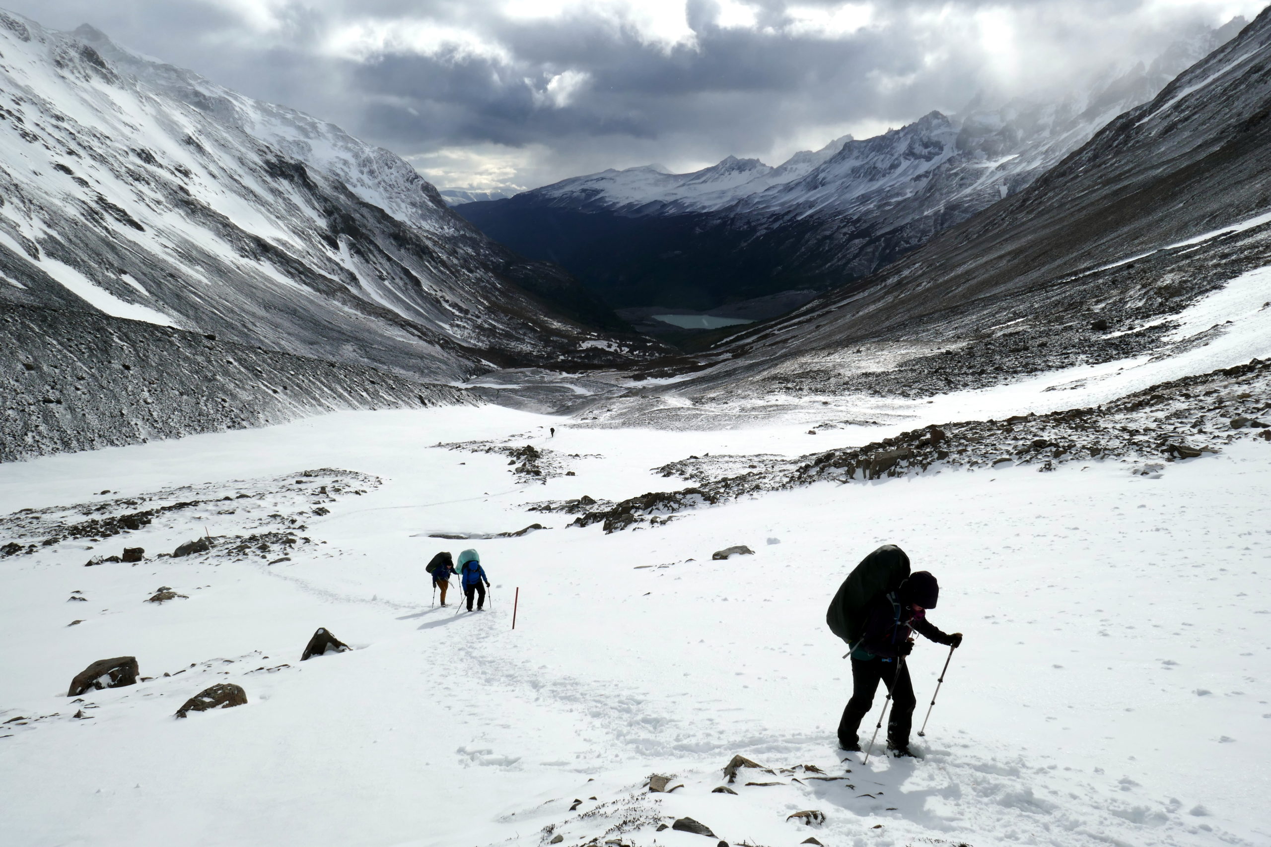
We awoke to a slightly surprising sight. Snow! Our tent had a light dusting, and the entire camp area was lightly blanketed. We’d set our alarms to get us up before the sunrise, in hopes of being packed up and on our way just when things would start brightening up. As such, we had the cookhouse mostly to ourselves, and were all packed up (with everything quite wet I should add), and heading our before many campers had started stirring much. Everything I’d read suggested starting as early as you could, just in case, and I took it to heart. Although our daily distance would only be 8.6km, the path was a very ‘pointy’ trail, with over 700m of climbing up one side AND descending back down on the other side of the pass. The entire day would be focused on getting up and over this magical pass, and we weren’t sure what to expect.
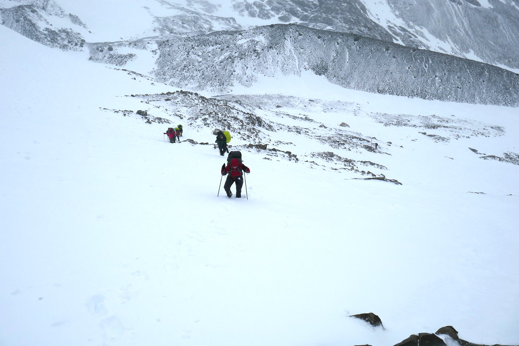
Our trail started once again with a bit of a forest scramble. I’d say it was the wettest we’d encountered, with lots of little stream crossings that put big puddles in our path. They also created some pretty big mud pits we had to tiptoe through, using our poles for balance. And it’s a good thing we had poles with us today. After emerging from the woods, we got a good look at the actual pass we had to cross. There was no trail per se. Just a wall of snow ahead of us. While mini crampons may have been helpful, we decided our boots and poles would be good enough. We felt back for others with poor footwear choices, and we knew they existed behind us.
Up to this point, we had pretty much been the trail breakers on this part of the circuit. There were two other groups that were pretty close to us. A group of 2 guys, and a foursome of friends. They were not far from us as we climbed. We eventually took a short break, and the two guys tried to forge a trail up the pass, in a spot where there were no markers. I took my time to consult a map and decided on a different attack route. I chose wisely. I watched as the snow got deeper and deeper for the other dude. Eventually he was hip-deep in snow, and had to actually circle back to join where I was heading. We still had it tough, but not as tough as him. This was where we definitely felt like we were on a real wild expedition, and where I felt most alive. It was nothing short of incredible cresting the pass. Of course, cresting the pass also meant coming face to face with the 2nd of the ‘wind icons’ on the map.

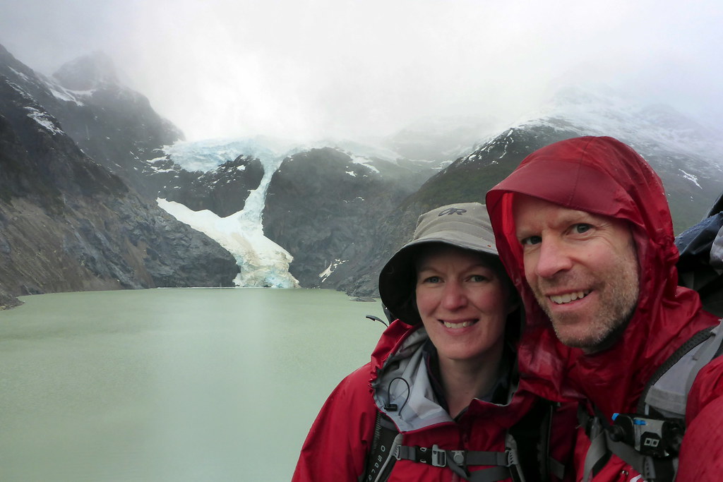
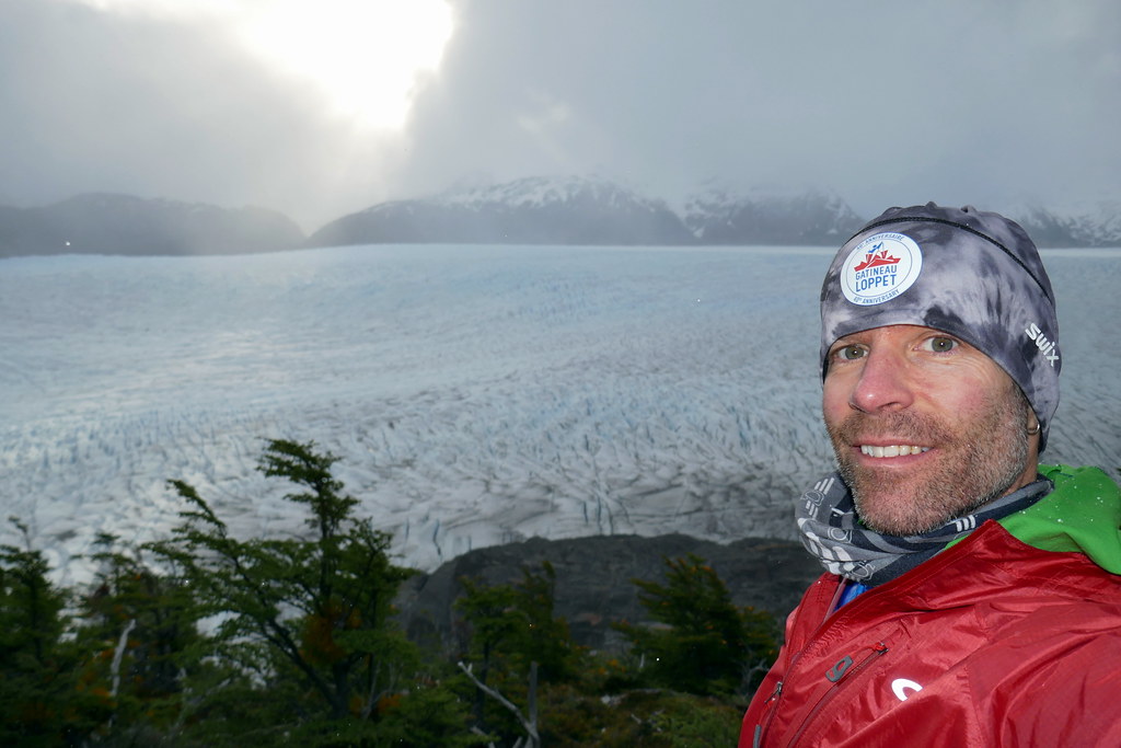
After finally cresting, we were met with one of the most amazing views I have seen in my entire life. Imagine you’ve just pushed hard up a mountain with a heavy pack with biting winds and snow blowing into your face. When you reach the top, you look over the other side, and before is a view that fills your entire peripheral vision. And that view is of the Grey Glacier! This bad boy is 6km WIDE and 28km LONG, and at least 30m tall. It was wild. And, we’d be walking with it to our right the rest of today and ALL of the next day. Just imagine that! Or even better, feast your eyes on this panorama taken just after cresting. Also, I did shoot a little video clip later in the day showing it grandeur.

Although climbing up the Gardner Pass was hard work, the descent was equally challenging. We found out the hard way that the trail on the other side was more or less a luge track. We watched hikers gently try to get on it, only to slip and fall, and tumble far down the mountainside. Luckily, in this area, we weren’t totally exposed, so they were only falling further down the trail. Unfortunately, it turned the trail into more of a luge track than a trail. Our poles helped, but even then, we took a couple little falls, but with no damage. It was almost comical, as we had expected this to be a pretty easy scramble back down. No such luck!
Somewhat ironically though, after probably only a few hundred meters, the trail turned back into normal forest trail. By now we’d passed the other hikers, and decided to just press hard and fast into our next campsite, Paso. We knew we’d be the first to arrive, but figured we may get a chance to air out / dry out our a tent a bit with the warmer air on this side of the pass (ironic, given we were next to a glacier!). Arriving at Paso, we were rather surprised to see that this whole campsite is basically hanging on near the edge of steep hills falling straight to the glacier. It made for interesting choices in campsites. There was one literally perched right over the glacier. Tempting as it was, I was worried about potential winds, so we opted for something a little set back with trees to give us some cover.
Once again, wrapping up early gave us a chance to relax and explore a bit. Deanna decided to take it a little easier and hung around camp with some fellow hikers. I was feeling a little restless, and went for a hike a little further up the trail. I found a perfect vantage point to enjoy a cup of tea and take in the views. It was a completely peaceful setting that I had all to myself at that moment, and I was thankful for that moment, as it capped off what I will consider the best day of the circuit. Yes, the Torres del Paine that we’ll see in the next post were amazing too, but this day felt just a little more ‘special’.
With that, I think I better close off this post. It has gotten quite long, but was a logical first instalment of the O Circuit. We’ll finish off the circuit in the next 2 posts before heading off to a few more special places in Patagonia. Looking back, this was good training for social isolation. Sharing a cramped tent, no ability to buy more supplies, and limited human contact for long stretches… and we loved it! We can get through this Pandemic with the spirit of adventurers! See you in the next post.