
Here we sit, ready for the fourth and final instalment of my series of posts from Iceland in 2016. Writing these up has [sadly] taken me 3.5 years, but I hope you’ve been enjoying them. This post covers the most terrain of the four, as this quarter of the country is pretty extensive. As you may expect with the Dreki, or Dragon, we’ll be heading to some areas pretty well known for its volcanoes. That includes the one called Katla, which is a huge volcano that had been threatening to erupt during our entire trip! In fact, we were not certain whether the roads to the south would even be open when we went through, it was that dicey at the time, based on some earthquake activity. Also in this corner is the Vatnajökull Ice Cap, the largest ice cap by volume in Europe. Over the 3 days the post covers, we’ll cover Seyðisfjörður, Höfn, Vík, and points in between. Lots to see and do, so let’s dive in!
Album of Photos from Kópasker to Seyðisfjörður
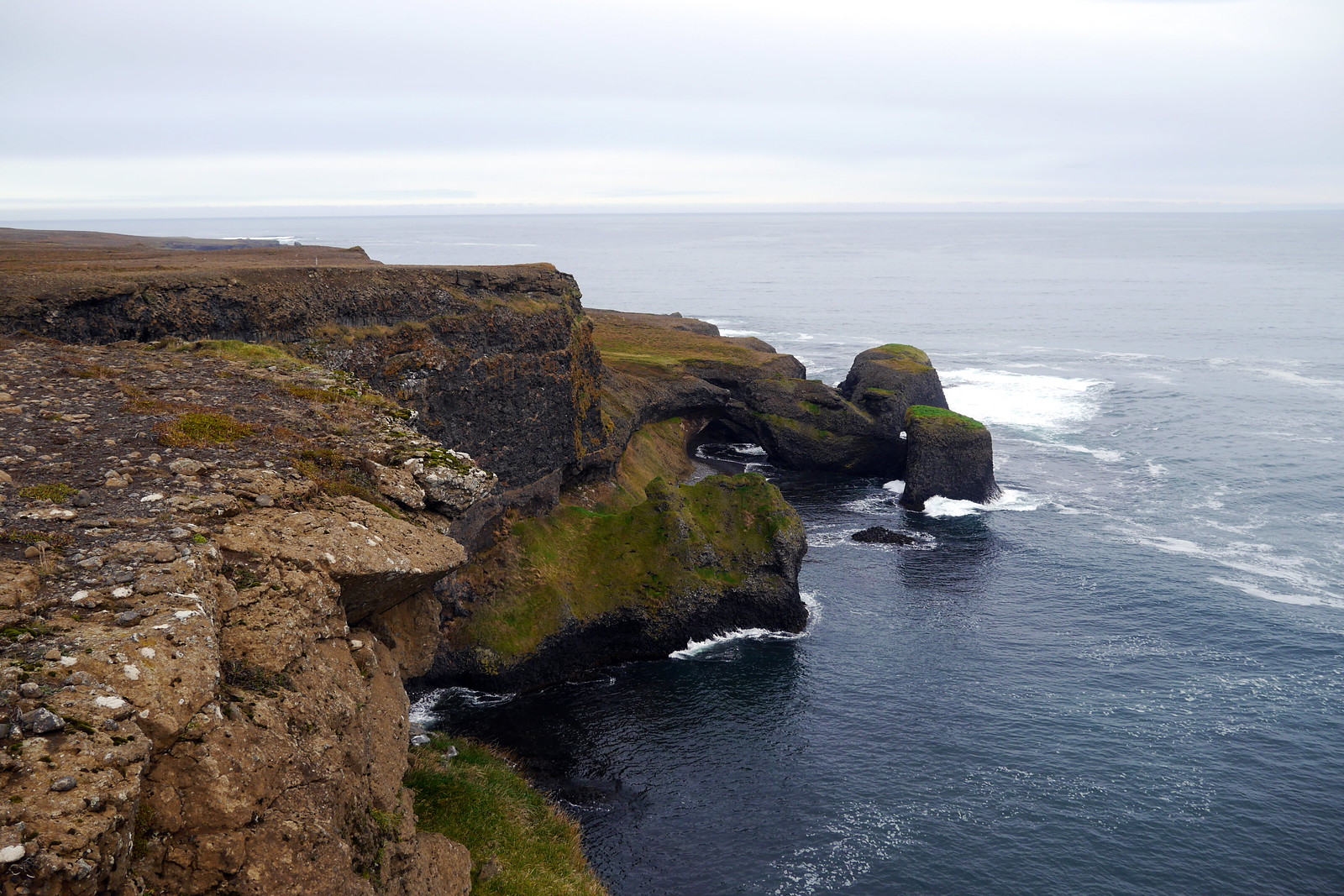
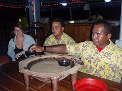
After heading way from the far north, and the cool Arctic Henge sight, our next destination for the day was a place called Seyðisfjörður. This little village of 750 people is nestled in a fjord, and the road to get there was very impressive, as you had to drive way up into the hills/mountains before diving way down into the village itself. This is also the place where ferries arrive from Europe. I imagine it makes for very interesting views as you get closer and closer to Iceland by water. Before arriving there, we got to drive by yet more stunning landscapes along the ring road. This included dramatic rock formations located at the Rauðanes Cape (photo above). We managed to go for a great little hike around here.

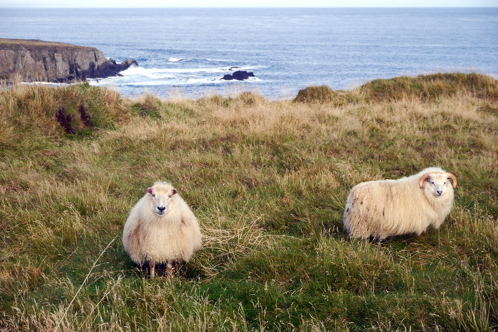
We also managed to get up close and personal with some more local wildlife, including some really hearty sheep. In fact, while trying to get a little closer to snap a picture, the stink eye I got from one them totally had me spooked and heading back to the car. There was just something about his eyes…
Obviously though, the highlights of this day have to just be the road itself. There are so many places where you dread having to make that daily drive, or have to deal with traffic. Out here, we had the narrow roads to ourselves, and the scenery was beyond belief ALL. THE. TIME. In all honesty, I would say spending 2-3 weeks would probably be the ideal amount of time in Iceland, giving you time to drive and take your time, as well as take a lot more hikes than we were able to.
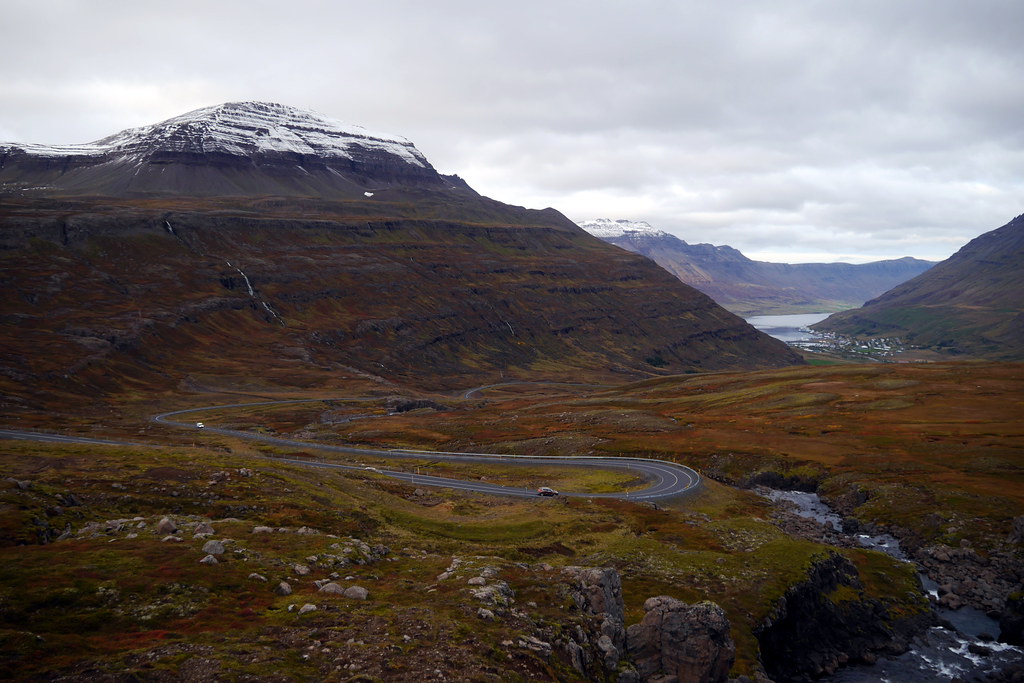
Driving over the mountain pass into Seyðisfjörður itself was a great experience. We experienced high winds on the drive up, but once you crested the pass and saw the expanse of the Fjord below, it was an amazing view. The town itself was obviously not a huge place, but very cute. Our hostel had great waterfront vistas. As a bonus, this time we were actually sharing the space with others, so had a little company while we prepared our supper. After eating, I went out for a nice night stroll to enjoy the fresh air and the magic of an Icelandic harbour. It was a nice cap to the day.

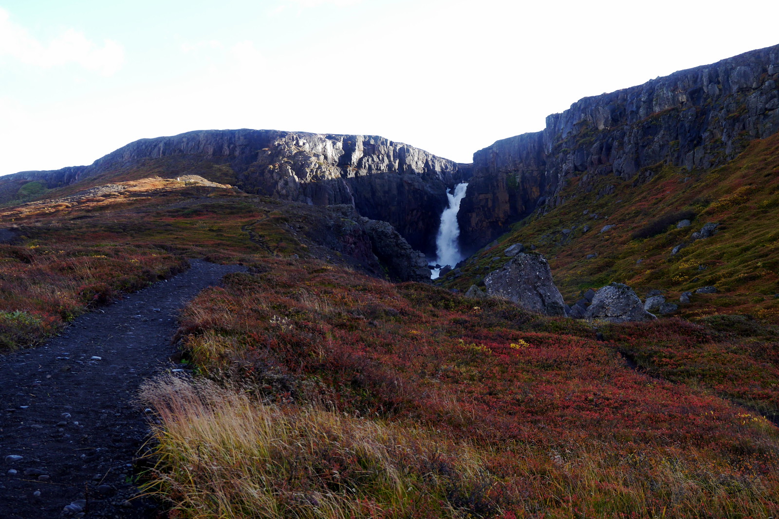
Getting underway the next day was, as you may have guessed, the reverse of the day before, as we had to climb back out of the fjord, over the mountain pass, and once again re-connect with the ring road. To get the blood flowing, we kicked things off with another great hike, this time to explore the Fardagafoss, seen in the below picture from a distance.
Album of Photos from Seyðisfjörður to Höfn
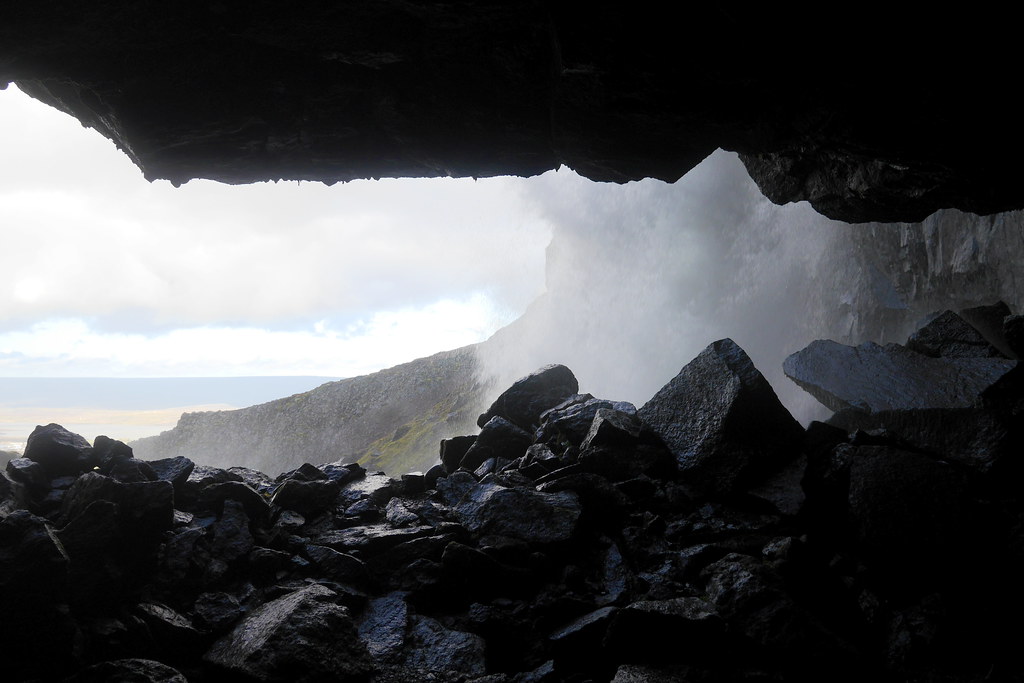
The cool part of this waterfall was the fact that you could actually climb around and behind it once you got close enough. So obviously I had to do that. I had on a rain coat, but neglected to put on my rain pants. In retrospect, that was a bit shortsighted, as sitting in soggy underpants in the car for the remainder of the day was sub-optimal 🙂 .
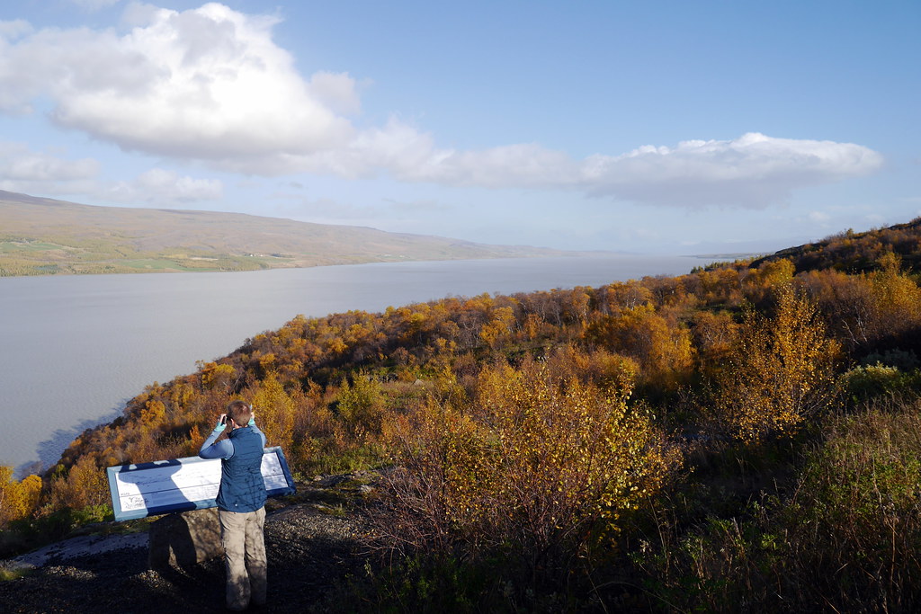
In spite of this, we had our missions for the day, and I wouldn’t let a wet butt hold me back. I’d say that on this day, the highlight, and main feature were our travel around Lagarfljót, a lake near the turnoff to Seyðisfjörður. There were two main reasons to visit this lake.
The first is for the Hallormsstaðaskógur national forest. This is one of the largest (of very few) forests in Iceland. It is also home to the only village that is located in a forest. There were lots of hiking trails as well as camping areas, and this is a significant vacation spot for Icelanders looking for the novelty of camping in a forest. For Canadians? Not so important. As such, while it was neat, I preferred the barren landscapes.
In addition to the forest, the lake itself is of such a size and shape that it attracts another persistent myth. After all, it is 25 km long and up to 112m deep! Yes, I speak of a lake monster. While not as well known as the Loch Ness monster or even Ogopogo, a monster nonetheless. In this case, his name is Lagarfljótsormurinn. Try as we might though, we did not spot him.
Undoubtedly though, the winner of this part of the trip were the waterfalls known as Hengifoss and Litlanesfoss. The trail to visit these great falls was at the far end of the lake, which is why we opted to drive all the way around. The hike to visit these falls was about 2 hours total, which made it about the right distance and time for our typical daily foot adventure. The first, and smaller of the two, Litlanesfoss, is not visible from the road, but is still a significant enough 30m drop over two steps. However, the real attraction to this fall are the amazing basalt columns which have been exposed all around in the gorge. You can also walk right up to the rim to gawk at the views here. No safety railing to be seen here. Just the way I like it!

One might be forgiven for thinking that Litlanesfoss was the destination. In reality however, you are only about halfway to the start attraction, the Hengifoss, in english known as the ‘hanging waterfall’. This bad boy is 128m high, and it is a straight drop. At this height, it is the 3rd highest waterfall in the country. Beyond the height, it is the framing that sets this one apart. Here is a good description of the falls:
Hengifoss waterfall is characterized by the rock layers of red clay sandwiched between layers of basalt creating red strata patterns – here you can see 5-6 million-year-old basalt layers from volcanic eruptions in the Tertiary Period. The multiple red stripes, as I call them, are sediments and old soil and the red colour stems from the oxidation of the iron in the clay. Very distinctive surroundings for a waterfall.
Taken from the Guide to Iceland post on the falls

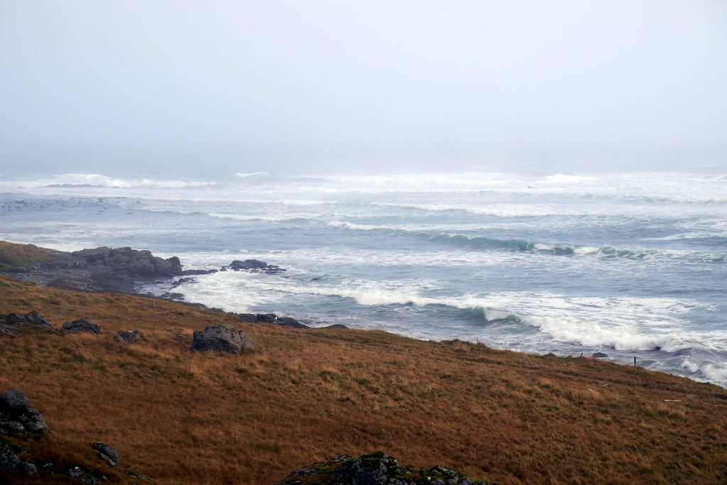
Once we’d had our fill of exploring around the falls and gorge (there were virtually no limitations on where you could walk), it was back to the car to continue the drive. The remainder of this day was spent driving along the ‘fjord fingers’ of the east coast, as I called them. This corner of Iceland can be characterized as rugged, remote, and sparsely inhabited. There were only tiny villages along the way. The scenery was beautiful. This is also the only area where the Ring Road is not completely paved. That’s right, the ONLY ‘national highway’ of Iceland still isn’t paved the whole way ’round! This was true ‘wild country.
The weather helped reinforce the ruggedness aspects of this part of the country. We had grey skies, on and off rain, and some real howling wind from time to time. At one stop where I wanted to snap pictures, I had to crouch behind rocks or small buildings, as I was sure I’d blow away. The hot dog diet hadn’t exactly fattened me up!
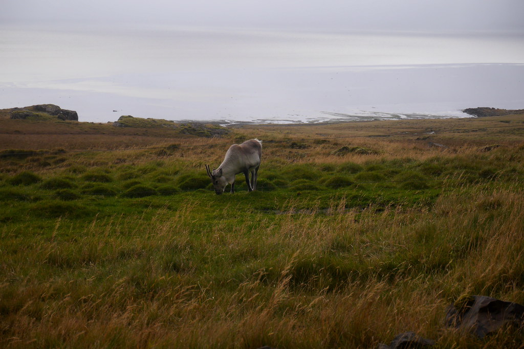
The final stop before Höfn, where we were sleeping for the night, was the Stokksnes peninsula. This spot was just a little off the main road. The attraction here was supposed to be great views of the Vestrahorn mountain. At 454m, and with steep cliffs rising out of a lagoon, it is a favourite with photographers. Today, however, was not the day. We couldn’t even see the mountain! I had to settle for a radar outpost and seeing some actual reindeer instead. This ‘horn’ was one of the first settlements of Iceland, and also featured prominently in Brtitain’s WWII efforts.
Album of Photos from Höfn to Vík


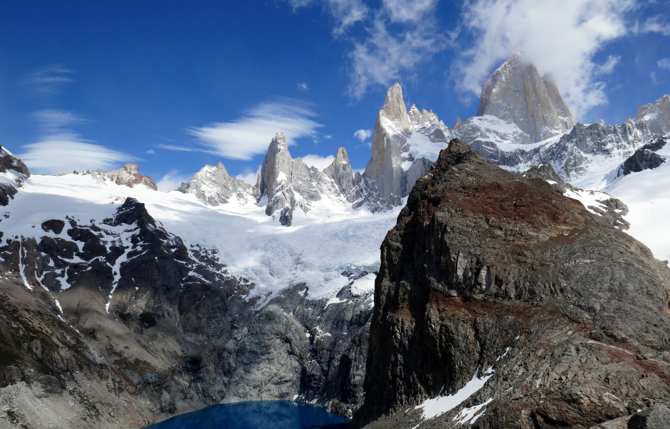
After a good night’s sleep in Höfn, we were ready for more exploring. Even though the weather was pretty dodgy when we started out, we didn’t want it to ‘dampen’ our spirits. As such, we geared up with waterproof tops and bottoms before heading out. The rugged theme continued today, as we were firmly in the shadow of the giant Vatnajökull ice cap. The land here is very much shaped by the forces of nature, be they ice or volcano. As such, we wanted to experience it first hand. I had pored over some trail maps to see if I could find a good trail for a hike, and I think I succeeded, as we had pretty impressive views of one of the leading edges of one of the glaciers from the ice cap (as you can see in the first album picture above. All in all, our hike was a couple hours. It may have taken longer, as at one point, I lost the track. I was relying on a combination of maps, markers, and GPS, as there wasn’t a really clear trail. However, that just led to more adventuring, which was fine by me (and grudgingly accepted by Deanna).

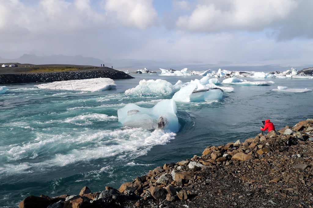
Our next stop was one of the ‘must do’ stops when visiting Iceland and taking the Ring Road. The so-called Diamond Beach is an area where you can admire a calving glacier, as well as explore a beach littered by baby icebergs that struggled to make it to the sea, giving the appearance of diamonds strewn along the beach. Make no mistake though, they are much bigger than the diamonds you are used to!
In this one area, we got to explore not one, but two glacial lagoons, the Jökulsárlón, home of the tourist stop Glacier Lagoon, as well as Fjallsárlón. Both feature opportunities to take ice boat tours closer to the glacier face walls. We stuck to exploring on foot and marvelling as massive chunks of ice would calve off, and make their way to the waterways leading to the ocean nearby. The ice activity was better at the former, and the views overall just a bit better at the latter.

From the glacier lagoons, it was just a short drive to the Vatnajökull National Park, and specifically the Skaftafell region. The reason for this stop was to some more hiking, as well as check out, can you guess it… another waterfall! This time, the waterfall in question is the Svartifoss (literally, the ‘Black Falls’). This park is one of those places that we would have liked to spend more time, as there was a great (and extensive) range of trails. If we’d had a full day available, we could have hiked to amazing heights with sweeping glacier vistas. However, due to our own time constraints, we had to settle for heading to the main view, which was this waterfall. And why was this one so special? Well, one look at the black basalt lava rock columns over which the waterfall spills over should be explanation enough!

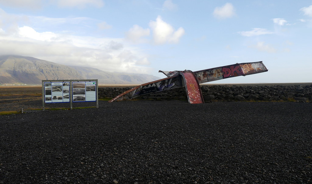
After leaving the park, the next bit of road exemplified the final type of terrain we’d traverse on this trip. Long stretches of black sand beaches carved by ice movements from even older volcanic actions. This section of the road has a ‘rocky’ history, with frequent glacier melt-off river floods leading to damage and road closures. In fact, at one spot, a bridge that was 880m in length was badly damaged by ice boulders the size of houses being washed down and floating on the swollen river! There was a monument to this damage at a pull-off that we checked out. The way the metal beams were twisted and deformed was hard to fathom!
After this full day of adventuring, we bunked down in the pretty little village of Vík í Mýrdal, or just Vík for short. This town of 300 inhabitants may not have a lot going on, but it has a stunning location and made for a great overnight stop. This would be our last stop before heading towards the Golden Circle (which we’ve already explored in post 1). As such, it was our last night in what would arguably be the quietest (tourist-related) part of the journey. Most people visiting this area are on buses shuttling between the Golden Circle and the Glacier Lagoon. As such, they miss the special little places like Vík and nearby views. Our hostel was quaint, and had a few other guests, so we had company this night as well.
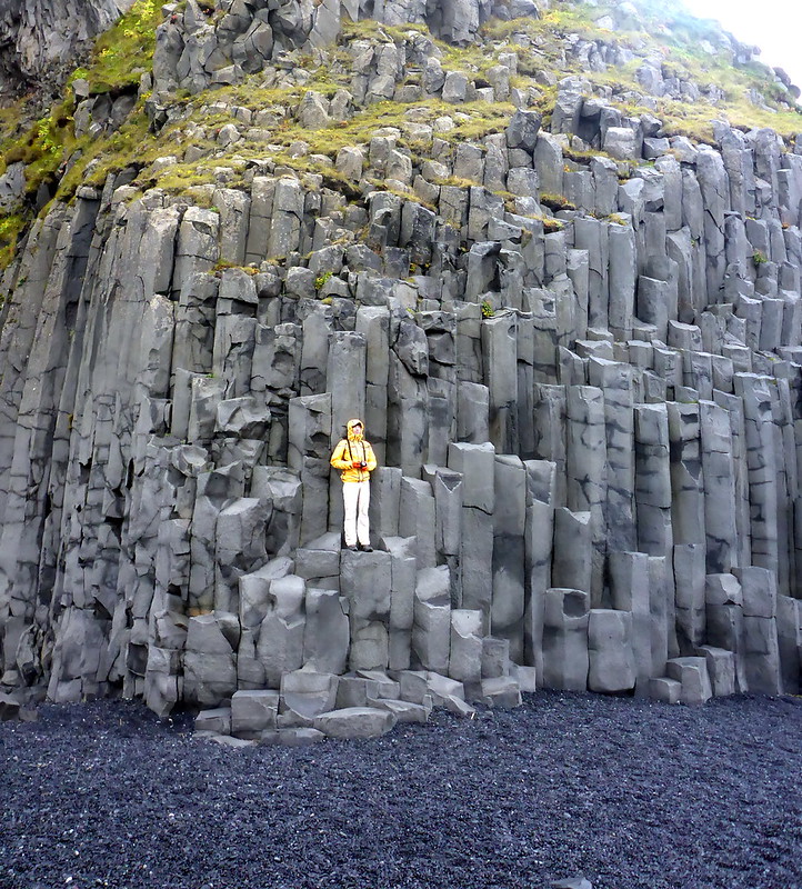
The views that I was particularly smitten with were the black sand beaches that ALSO featured the dramatic black basalt stone columns I was so fond of. Since we were sleeping a stone’s throw away from the waterfront, we got to visit this beach early and with a complete lack of tourists (although I’m sure the rough weather had something to do with that. The name of this place was Reynisfjara Black Sand Beach, and is apparently the most famous of the black sand beaches of Iceland. That was not evident on our trip, as it was mostly deserted!
On this beach, I was able to stroll freely in the black lava sand / pebbles. I was also able to play on and scale the basalt columns I’d only seen from afar in other places. In addition, there was even a little (big?) cave in the basalt we got to explore. It was more like an amphitheatre or something, but pretty cool. Finally, the rugged ocean and distant rock formations all added to the allure.
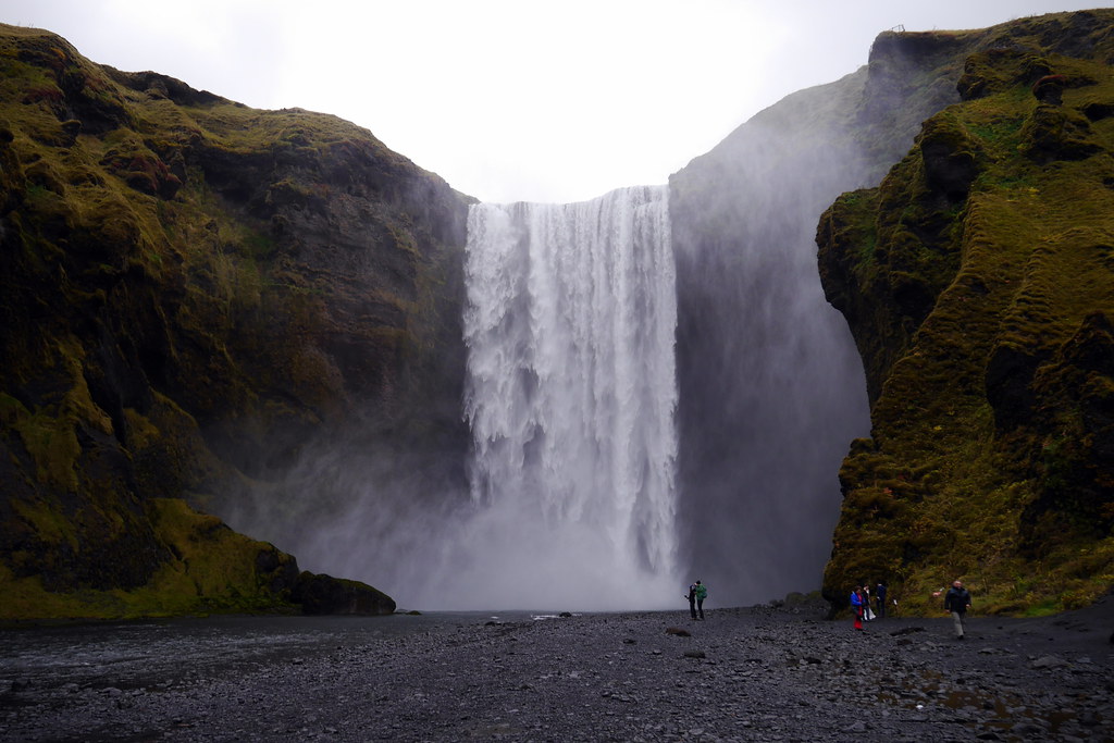
To cap off the Southeastern Iceland section of the trip, there was just ONE more waterfall we opted to pay a visit to. This time, it was the Skógafoss (there’s a great video of the falls at that link). This waterfall is 25m wide, and falls a distance of 60m. The waterfall also marks a clear boundary between the coastal area of the south, and the highlands. The best part of this waterfall is the fact that once again you can get up close and personal with it, both on the bottom and the top.
With this final image of a waterfall, I believe it is time to draw this post to a close. This also concludes my four-part series on Iceland. It was fun for me to go back and re-visit this captivating trip. I’ve been wanting to write about it for a while, but I was too daunted to re-visit all the complex place names :-). The fact that we are self-isolating right now for the Covid-19 Pandemic is giving rise to creativity in people all around the world. For my part, it was a kick in the pants to start writing a bit again. I have found it both challenging and therapeutic. Whether or not anyone actually reads these isn’t the point for me. It will make for a great future ‘time capsule’ to look back on and smile. At any rate, there are plenty more stories to come, as I have yet to put fingers to keyboard on our Patagonian Adventures of 2018! Those will also take some time, but keep an eye out for them! Take care all!


